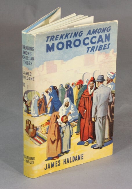
101. Trekking among Moroccan tribes. London: Pickering & Inglis, 1948.
$35
First edition, 8vo, pp. 192; 13 photographic illustrations on plates, several in color; slight rubbing to jacket, else near fine.
Haldane was an English missionary in Morocco.

102. A summer vacation. Four sermons. Boston: Roberts Bros., 1874.
$150
First edition, 12mo, pp. 75; original pink printed wrappers, slightly faded and soiled and with a small chip along the bottom edge of the front cover; very good.
"Worship in Europe," "The Vienna Exhibition," "Pilgrimages," and "Open Air and Aryan Virtues."
Not in Smith, American Travellers Abroad (although 6 other Hale titles are).
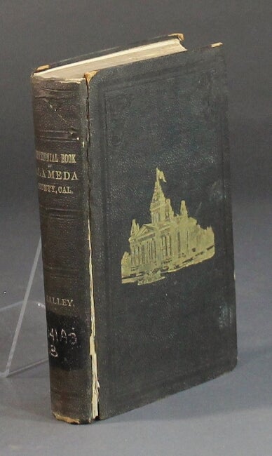
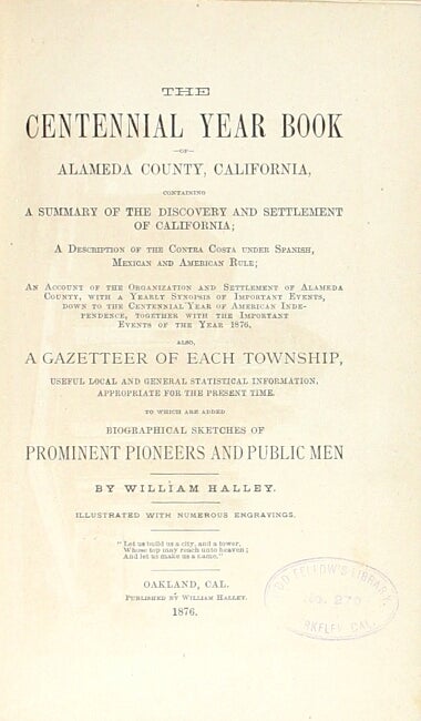
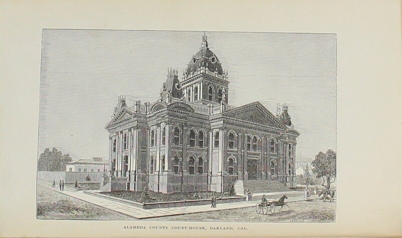
103. The centennial year book of Alameda County, California ... An account of the organization and settlement of Alameda County, with a yearly synopsis of important events ... also, a gazetteer of each township ... biographical sketches of prominent pioneers and public men illustrated with numerous engravings. Oakland: William Halley, 1876.
$150
First edition, 8vo, pp. xv, [1], 586, [6]; wood-engraved frontispiece of the Alameda courthouse and 13 wood-engraved plates; illustrated ads throughout; original pictorial black cloth stamped in gilt on upper cover and spine; upper joint cracked and weak, ex-Odd Fellows library, with call number on spine, bookplate, and stamps throughout text, "Huston" written in ink on fore-edge, textblock relatively clean and sound.
"Leaves of advertisements have been incorporated throughout it, which have not graced the work; but despite this undignified feature the contents form the best source of authority that we have for the history of this county" (Cowan).
Cowan, p. 103.

104. Program of itineraries, rates, and conditions of the Hamburg-American line's grand winter cruises to the West Indies, the Spanish Main, the Panama Canal, and Nassau [cover title]. New York: John C. Rankin Co., 1909.
$35
12mo, pp. 20; printed on blue paper; self-wrappers; contemporary rubber stamp for the St. Paul, Minnesota travel agent J.D. Zook at head of upper cover, else very good and sound. Special emphasis on cruises aboard the "Magnificent Twin-Screw Steamer 'Oceana,' a vessel of large dimensions, specially constructed and equipped for pleasure travel".
Not in OCLC as of October, 2013.
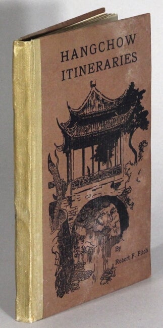
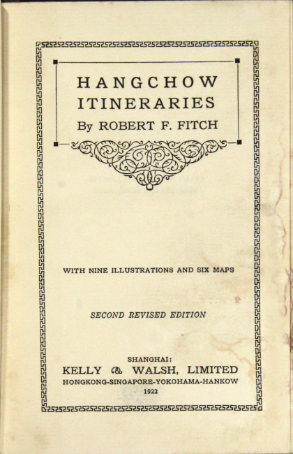
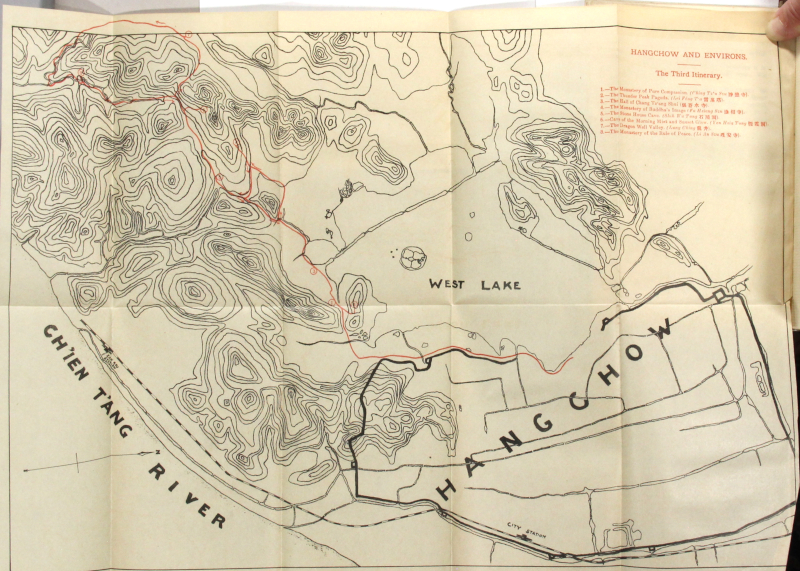
105. [Hangchow.] Hangchow itineraries ... Second revised edition. Shanghai: Kelly & Walsh, Limited, 1922.
$250
12mo, pp. [6], 55, [3], [10] ads; folding panorama, 6 folding maps, 8 plates; original pictorial paper-covered boards, tan cloth shelfback; fore-edge dampstained causing some wrinkling to the plates (but not the maps); all else very good and sound.
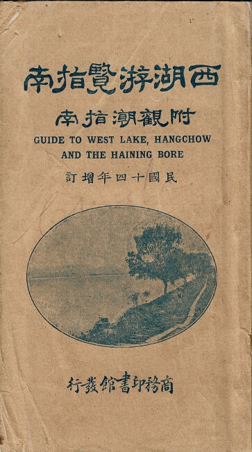
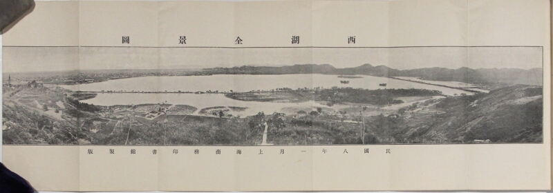
106. 西湖游覽指南 : 坿觀潮指南 / Guide to West Lake, Hangchow, and the Haining Bore. Shanghai: Commercial Press, 1925.
$375
16th edition, 6.75 x 3.75 in., pp. [8], 1, [1], 2, 5, [1], [2], 138, 25, [9]; folding panorama, photoreproductive text illustrations showing various landmarks; tan printed paper wrappers; text in Chinese; wrappers creased with corner reinforced with tape, spine chipped, text clean and sound, good.
11 various editions in OCLC, all of a later date.
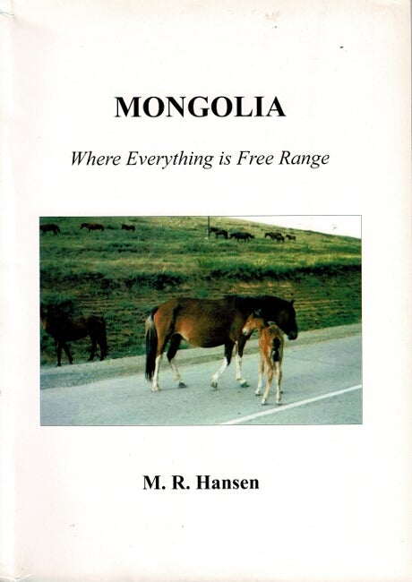
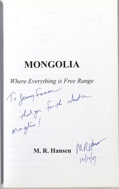
107. Mongolia where everything is free range. N.p.: [2007].
$150
8vo, pp. [4], 171, [1]; 157 color illustrations throughout, almost exclusively from photographs; original pictorial wrappers; near fine throughout.
Inscribed "To Jenny Sorensen, Thank you for the interest in Mongolia! / M. R. Hansen / 12/14/07."
A professor from South Dakota School of Mines & Technology and his wife travel to Mongolia as part of an exchange program with the Mongolian University of Science & Technology.
OCLC locates one copy only, in Hungary.
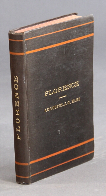
108. Florence. Second edition.. London: George Allen, n.d., [1887 or after].
$35
8vo, pp. [2] ads, [4], 525; double-p. map printed in color, illus. in text; occasional light pencil marginalia, last leaf scraped; all else very good in original black cloth stamped in gilt and red on upper and spine.
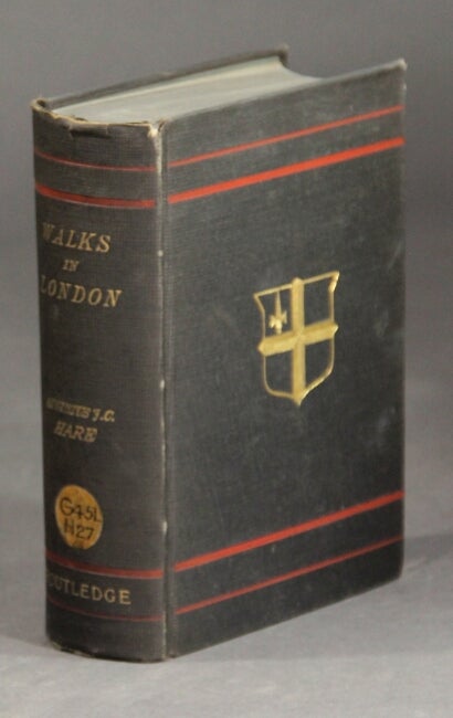
109. Walks in London. New York: George Routledge and Sons, 1884.
$50
2 volumes in 1, 8vo; wood-engraved illustrations throughout text; ex-MHS with bookplate marked withdrawn and old accession label on spine; terminals browned, spine ends rubbed with small cracks, else very good in original gray cloth, gilt-titled spine, gilt vignette on upper cover.
The first volume is on the City; the second on the West End. Hare (1834-1903) arranges these walks so the tourist can see as many objects of interest as possible. Popular and well-respected guide book first published in 1878.
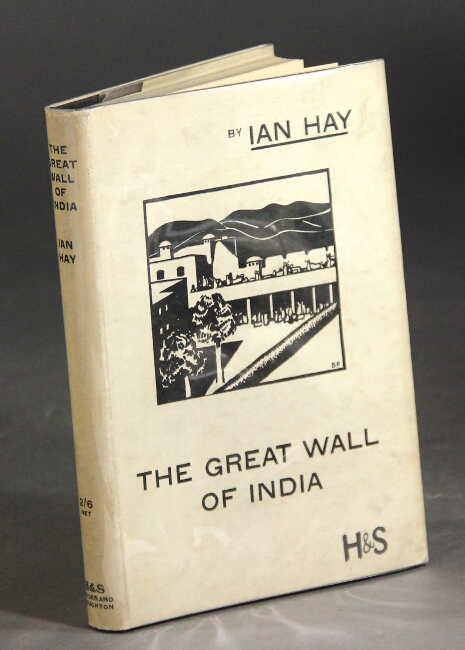
110. The great wall of India. London: Hodder and Stoughton,, [1933].
$45
First edition, 12mo, pp. [3]-96; 6 woodcuts; fine copy in a slightly soiled jacket.
First time visitor seeks to understand the cultural barriers India presents.
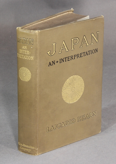
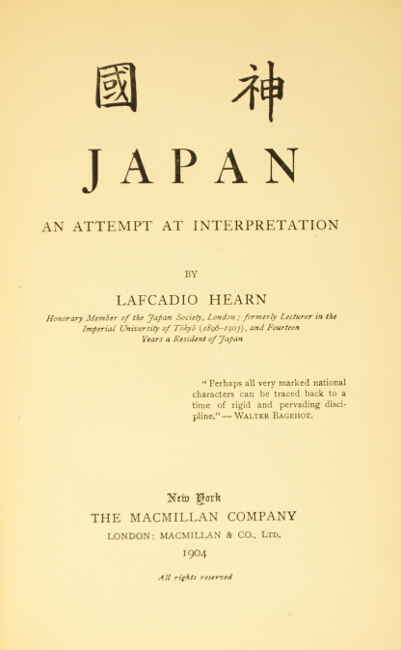
111. Japan: an attempt at interpretation. New York & London: Macmillan, 1904.
$200
First edition, 8vo, pp. v, [1], 541, [3]; frontispiece; original tan cloth stamped in gilt and black, spine gilt, t.e.g.; short tear to cloth at one corner, upper hinge cracked, else a very good copy.
A rich introduction to Japanese culture including the various religious "cults," social organization, education, the military, and more. BAL 7941.
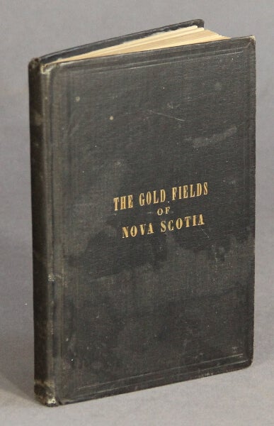
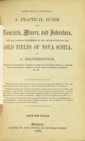
112. A practical guide for tourists, miners, and investors, and all persons interested in the development of the gold fields of Nova Scotia. Montreal: John Lovell, 1868.
$175
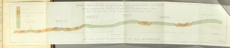
First edition, 16mo, pp. [2], iv, [2], [7]-170; hand-colored folding frontispiece plan of the gold field of Nova Scotia, 2 folding tables (1 split along 1 fold); some inconspicuous stains to both covers, else a very good copy in original brown cloth, gilt-lettered on upper cover.
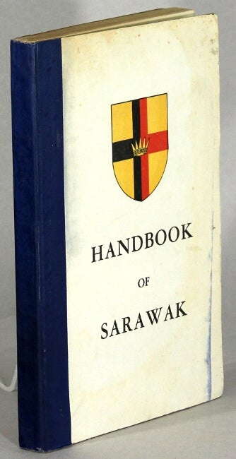
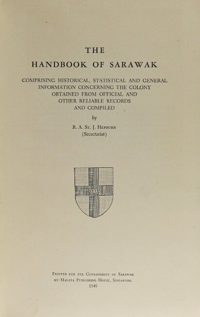
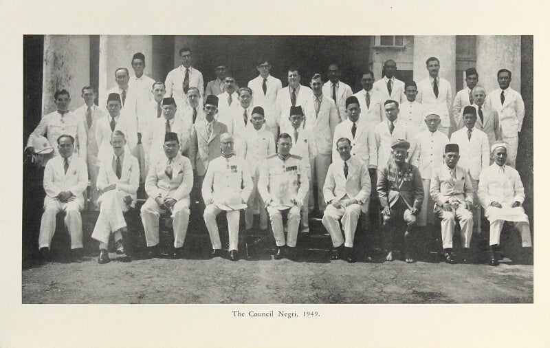
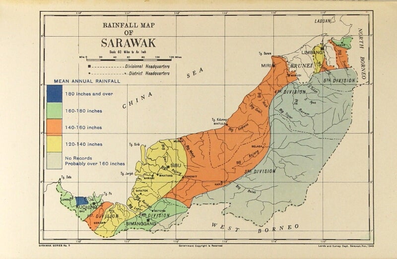
113. Handbook of Sarawak comprising historical, statistical, and general information concerning the colony obtained from official and other reliable records. Printed for the Government of Sarawak: by Malaya Publishing House, Singapore, 1949.
$175
8vo, pp. [26], 194, [14] ads; large folding color map of Sarawak, 2 folding tables, 30 plates and maps; original pictorial paper-covered boards backed in blue cloth; transfer stain line on upper cover; all else very good and sound.

114. Three lengthy letters from a Hong Kong expat to her friend in the States. Hong Kong: 1900-1901.
$1,250
Three quarto manuscript letters totaling 22 pages and approx. 6000 words on life in Hong Kong as an American expat. Clean and legible.
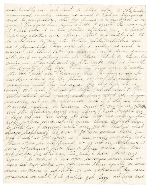
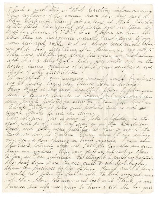
The author, "Katheryn," writes to her friend Jesse in Oregon, describing her daily routine and life in Hong Kong with her husband Tom, who works there. "Hong Kong is the most beautiful place I have ever seen. I cannot describe it to you but will send you some Kodak pictures." Her writing is rather slangy and telegraphic, but she manages to convey a sense of her life and times. "We have a rickshaw of our own now, Tom bought it last week. It is a nice one, made in Japan, and better than the ones they make here. Have two coolies so they can drag Tom up the hill. One runs behind and pushes. A tailor is making their uniforms. I chose kahki (sic) trimmed with red for them, Will also have the monogram TWH in red letters on them. People here think you are somebody if your coolies are in uniform."
She goes on at length in this manner, explaining that the chair coolies (necessary to negotiate the many steps in Hong Kong) do not like Tom because he weighs 200 pounds. She, on the other hand, goes where she pleases. She discusses her wardrobe (all white clothing) and talks about clothing and Chinese tailors, and about friends of her husband's - other expats. She describes their rooms, a bargain at $160 per month. Then, "Although the Plague is usually worse here in summer it seems now that there are fewer cases than there were a few weeks ago... I go through the Plague district (that is, where it is the worst) Wauchai, a suburb, nearly every day."
She also talks about ships currently in the harbor, “trouble in the north" and the Hong Kong regiment. We gather that she's been married just a year, and that her husband pampers her, but that she misses her friend Jessie and is a little homesick. The first twelve-page letter was written between June 19 and 25. The second, a two-pager sending condolences for a death in Jessie's family, was written August 27, 1900. The third letter, eight pages, was written in 1901. In it Kathryn talks about cameras and mentions their trip to Canton and Macao.
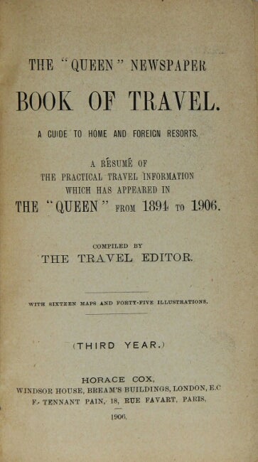
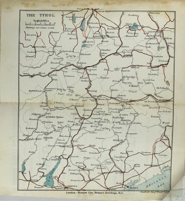
115. "The Queen" Newspaper book of travel. A guide to home and foreign resorts. A résumé of the practical travel information which has appeared in the "Queen" from 1894 to 1906. Compiled by the travel editor (M. Hornsby, F.R.G.S.) With sixteen maps and forty-five illustrations ... (third year). London: Horace Cox, Windsor House, Bream's Buildings; Paris: F. Tennant Pain, 18, rue Favart, 1906.
$125
8vo, pp. viii, 504; 15 maps (13 folding), 41 plates and 4 illustrations in the text; some toning, but on the whole a very good copy.
The Queen was a newspaper for women, and the contents of this guide book is geared towards women travelers. Switzerland, Italy, Austria, France, Germany, Scandinavia, and India are well represented, plus smaller sections on New Zealand, Australia, the East and West Indies, and others. Numerous advertisements throughout, much of it aimed at women.
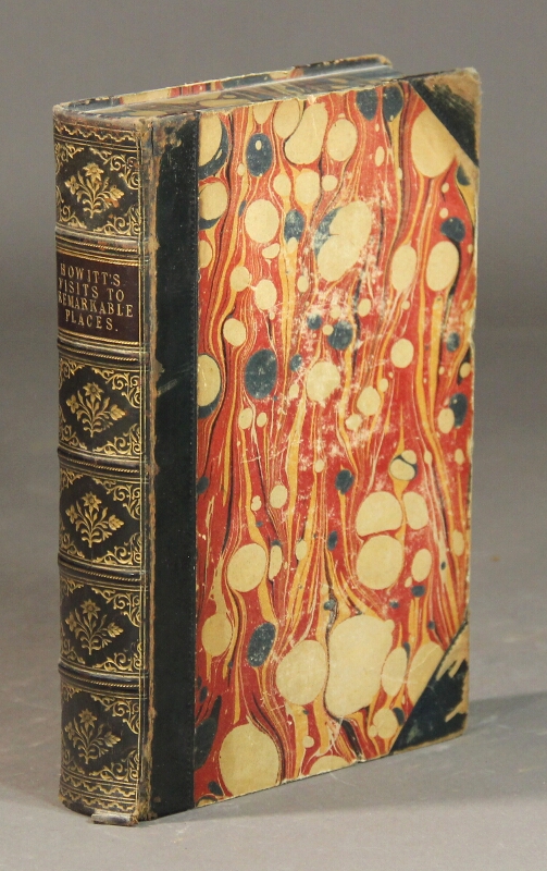
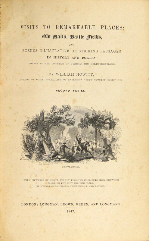
116. Visits to remarkable places: old halls, battle fields, and scenes Iilustrative of striking passages in English history and poetry: chiefly in the counties of Durham and Northumberland. London: Longman [et al.], 1842.
$150
Second series, 8vo, xi, [1], 610; with woodcuts from drawings made on the spot by Camichael, Richardsons, and Taylor; contemporary quarter calf over marbled boards, spine gilt in six compartments, marbled edges and endpapers; binding rubbed, especially at joints and corners, mild foxing to first and last few leaves, else a very good, attractive copy with the elaborately gilt spine in lovely condition.
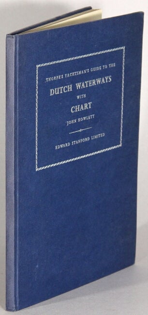
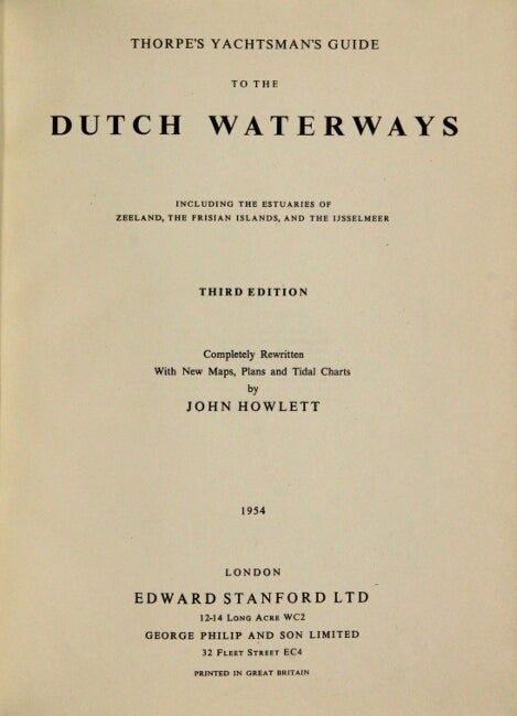
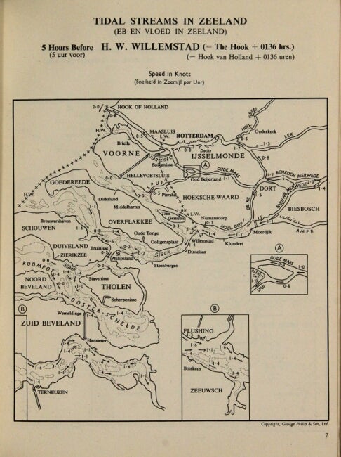
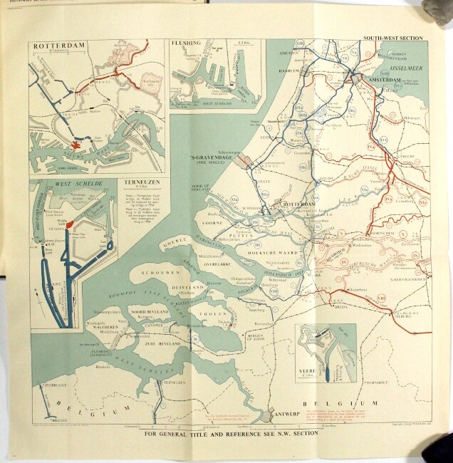
117. Thorpe's yachtsman's guide to the Dutch waterways including the estuaries of Zeeland, the Frisian Islands, and the Ijsselmeer. Third edition completely rewritten with new maps, plans, and tidal charts. London: Edward Stanford Ltd, 1954.
$45
4to, pp. vii, [1], 47, [1]; 4 folding color charts, tables and charts throughout the text; fine copy in original blue cloth stamped in silver on the upper cover.
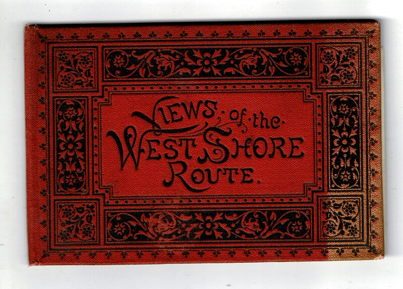
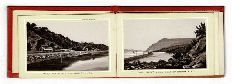
118. [Hudson River.] Views of the west shore route [cover title]. New York: Wittemann Bros., n.d., ca. 1882.
$45
3¼" x 5¼", accordion fold with 12 photo-lithograph panels printed in sepia and white, showing the railroad stations, railroad bridges,views of Cornwall-on-Hudson and West Point, etc.; original decorative red cloth (fore-edge a little faded) stamped in black; one fold separated, several others partially so; good.
With 5-panel advert for Wittemann affixed to rear pastedown announcing various "souvenir albums, containing photo-views by Louis Glaser's process."
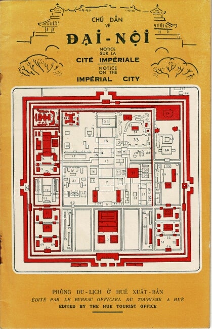
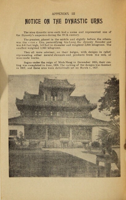
119. Chú dan vè Ðai-Noi. Notice sur la Cité Impériale. Notice on the Imperial City [cover title]. Hue: Hue Tourist Office, [1948].
$150
8vo, pp. 24; illustrated throughout; pages toning, ownership signature on p. 1, else very good in original yellow printed wrappers.
Tri-lingual guide book to the imperial city of Hue.
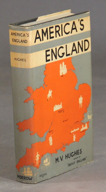
120. America's England. New York: William Morrow & Company, 1930.
$35
12mo, pp. x, 342; frontispiece, illustrations throughout, map front endpapers; publisher's cloth in original grey and white pictorial dust jacket, toning, a few small chips and tears along jacket edges, else a near fine copy. Guidebook for Americans traveling in England.
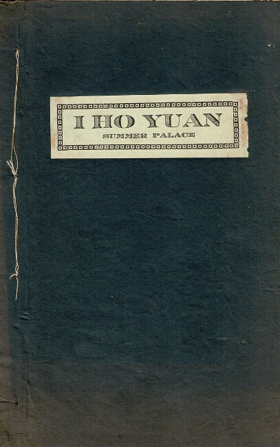
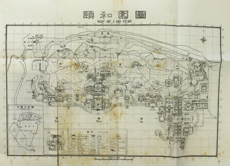
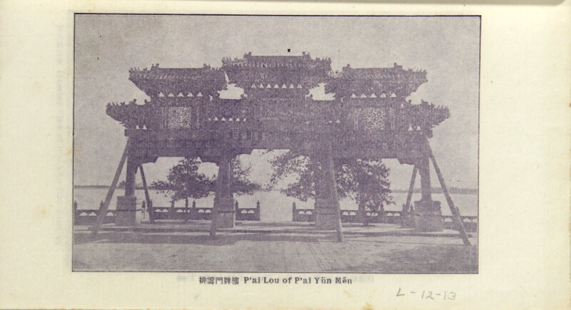
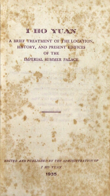
121. I Ho Yuan. A brief treatment of the location, history, and present edifices of the Imperial Summer Palace. [Beijing]: I Ho Yuan, 1935.
$100
12mo, pp. [4], 49, [1]; 24 plates, folding map; stab stitched, blue paper wrappers, title label on upper wrapper; binding string snaped in a couple of places, foxing, pencil marginalia throughout corresponding to penciled grid labeling on the folding map, good.
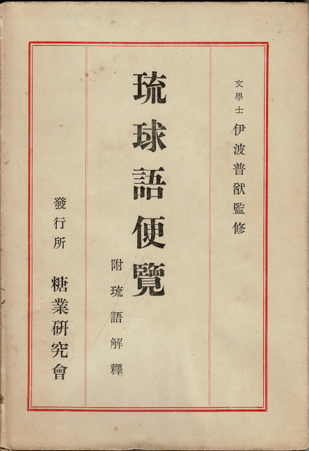
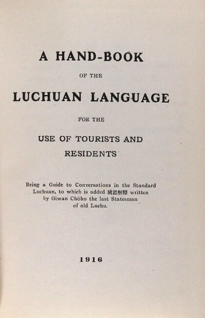
122. 琉球語便覽 : 附琉語解釋 = Hand-book of the Luchuan language for the use of tourists and residents being a guide to the conversations in the Standard Luchuan, to which is added 琉語解釋 written by Giwan Chōho the last Statesman of old Luchu. Tōkyō: Tōgyō Kenkyūkai, 1916 [i.e. Ryūkyū Shiryō Fukkoku Hanpukai, 1969].
$125
Second edition after that of 1916; 12mo, pp. [4], 123, [1], 14, [2], 7, [5]; text in triple column; fine copy in brown leather lettered in gilt on spine, in a near fine dust jacket.
The Ryukyuan languages (also Lewchewan or Luchuan) are the indigenous languages of the Ryukyu Islands, the southernmost part of the Japanese archipelago.
Brown, Chicago, Hawaii, Ohio and Berkeley in OCLC.
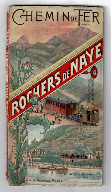
123. Vue panoramique prise du sommet des Rochers de Naye (2044m.)...Dessinée et gravée par X. Imfeld. n.p.: publiée par les Compagnies de Chemin de Fer, n.d., [ca. 1890s].
$250
Large chromolithograph panorama approx. 8½" x 124", folding into narrow octavo-size stiff pictorial chromolithographic wrappers; spine split and chipped (no obvious loss), edges worn; the wonderful panorama itself, with each peak identified in type in the upper margin, and with ads on verso printed in red and black, some illustrated, is fine, and very attractive.
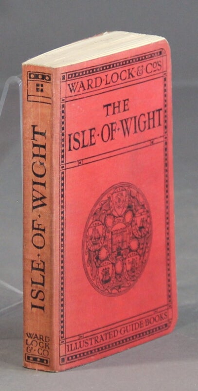
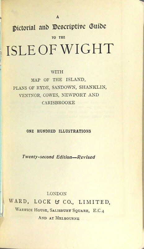
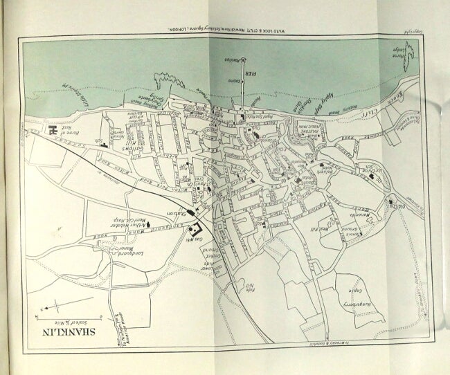
124. [Isle of Wight.] A pictorial and descriptive guide to the Isle of Wight with map of the island, plans of Ryde, Sandown, Shanklin, Ventnor, Cowes, Newport and Carisbrooke. One hundred illustrations. Twenty-second edition, revised. London: Ward, Lock & Co., n.d., [ca. 1930].
$50
12mo, pp. xvi (ads), xv, [1] ads, 184, 64 (ads); ads on endpapers, folding map printed in 2 colors, 6 (5 folding and printed in 2 colors), 5 sketch maps, and numerous plates from photographs; a very good copy in original pictorial limp red cloth printed in black.
Many citations in OCLC for the Ward, Lock guides, but not that for the Isle of Wight.
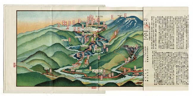
125. 日光名所図絵 / Nikko. Tokyo: Taishomyoshozuesha, 1919.
$75
Color folding map, 7½" x approximately 2' 6", depicting a color bird's eye view of Nikko, Japan, with labels in English and Japanese. The map verso has a description of the area, also in English and Japanese, alongside additional illustrations and a road map. Contained in stiff green illustrated covers, fine, with light rubbing to cover extremities.
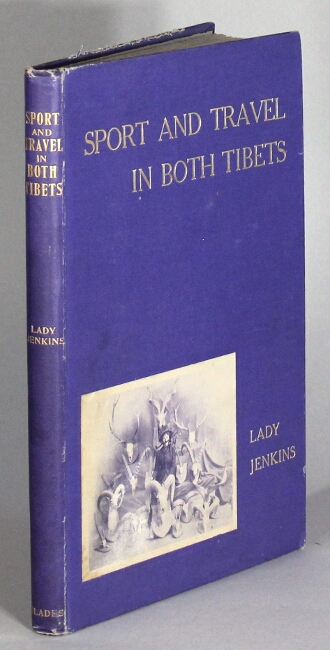
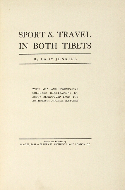
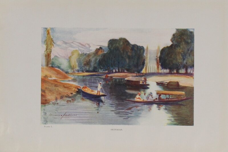
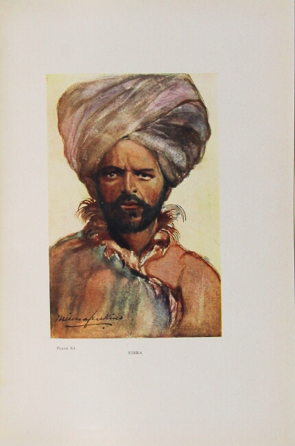
126. Sport & travel in both Tibets. With map and twenty-five coloured illustrations exactly reproduced from the authoress's original sketches. London: printed and published by Blades, East & Blades, [1909].
$425
Only edition, tall 8vo, pp. [6], 87; double-p. map, 25 color plates; a bit of wear at extremities, else very good in original purple cloth stamped in gilt on upper cover and spine, pictorial pastedown on upper cover.
Lady Jenkins was not just an artist, but also a crack shot: among her trophies were gazelles, antelopes, ibex, burhel, and markhor. "One of the handful of Edwardian-era women who embarked on her own hunting expeditions, Lady Jenkins departed from Srinagar, traveled through Leh and Miroo and into the high country of Changchenmo ... She and her guides suffered from altitude sickness, lack of food, and severe weather" (Czech).
Czech, Asia Big Game Hunting, p. 112; Yakushi J83.

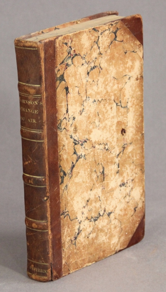
127. Change of air, or the philosophy of travelling; being autumnal excursions through France, Switzerland, Italy, Germany and Belgium; with observations and reflections on the moral, physical, and medicinal influence of travelling-exercise, change of scene, foreign skies, and voluntary expatriation. To which is prefixed, wear and tear of modern Babylon. New York: Samuel Wood and Sons , 1831.
$150
First American edition, 8vo, pp. viii, 326; all edges marbled, early owner's name on upper edge of preface, occasional foxing, extremities lightly rubbed and worn, spine hinge partially cracked w/small worm hole, else a very good sound copy in half calf over marbled boards, gilt lettered spine with raised bands.
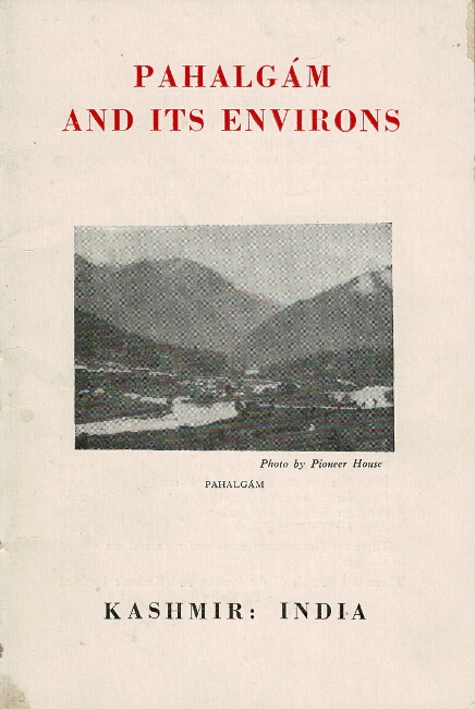
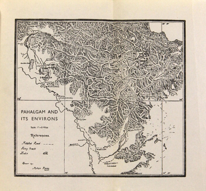
128. [Kashmir.] Pahalgam and its environs. Kashmir India ... Third edition. [Mysore: printed by K. A. Korula at the Wesley Press, [ca. early 1960s].
$45
7¼" x 5¾", pp. iii, [1], 31, [1]; folding map and 7 photoghraphic illustrations on rectos and versos of 2 plates; near fine in original pictorial wrappers. Includes the preface to the first edition which was originally printed in 1955; this third edition looks to be early 1960s. No editions are found in OCLC.
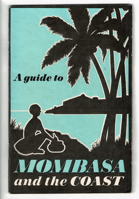
129. [Kenya.] A guide to Mombasa and the coast [cover title]. Mombasa: East Africa Tourist Travel Assn., under the auspices of the Mombasa Municipal Council, n.d., [ca,. 1949].
$45
8vo, pp. 68; rear wrapper folds out to display a plan of Mombasa,map inside front wrapper, color and black & white illustrations throughout; near fine in attractive pictorial wrappers. Eighteen sections covering such items as climate, health & wellbeing, fishing, commerce & industry, etc.


130. Official guide for shippers & travellers to the principal ports of the world, 1933-34. [Osaka, Japan]: Osaka Shosen Kaisha, Osaka Mercantile Steamship Company Limited, 1933-34.
$275
Twentieth edition; Large 4to, pp. [2], 634; thumb-indexed; illustrated throughout with maps, advertisements, halftones, decorative initials, drawings, much in color; original blindstamped black cloth, gilt-stamped spine; front free endpaper excised, the first 50 or so leaves wrinkled, all else generally very good, sound, and clean.
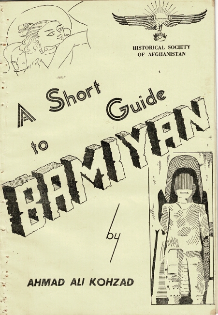
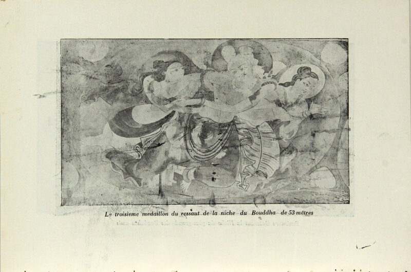
131. A short guide to Bamiyan [wrapper title]. Kabul: Historical Society of Afghanistan [printed by The Government Central Press, [1955].
$100
10¼" x 7¼", pp. 12; 25 illustrations on rectos and versos of 8 plates; original pictorial yellow wrappers; removed from a stapled binding with multiple tiny holes in the gutter; all else very good.
Three in OCLC, only LC in the U.S. The cataloguing for the LC copy was done by someone who may have had too much time on their hands, but who have provided nonetheless a valuable summary:
"This booklet is a brief guide to the Bamiyan Valley and the surrounding archaeological sites in central Afghanistan, published in the 1950s by the Historical Society of Afghanistan. For centuries, the valley was famous for its two Giant Buddhas, carved into cliffs in the fourth and fifth centuries, where they stood until the Taliban destroyed them in 2001. The guide begins with a brief description of the road from Kabul to Bamiyan, some 240 kilometers to the northwest. It offers in short sections information on the geography and history of the valley, which served for centuries as a Buddhist pilgrimage center and a commercial crossroads between China, India, Persia, and the Roman Empire on the southern branch of the Silk Road. The booklet gives early accounts by Chinese monks and travelers who visited Bamiyan in the seventh and eighth centuries. A few sections describe the two colossal statues, giving details about the murals and paintings on the niches and about the ancient grottoes that were once monasteries. The final sections are dedicated to other sites of interest, such as one in the nearby valley of Kakrak, where a smaller Buddha and other grottoes also exist. Images of the statues and the murals illustrate the guide, separating the English version from a French account that shares some of the same information, but focuses on the dynasties that ruled in Bamiyan before and after Islam. The author, Ahmad Ali Kuhzad (1907-83), was curator of the Kabul Museum and the first president of the Anjoman-e Tarik-e Afganestan (Historical Society of Afghanistan). The society was founded in Kabul in 1942. Its mission was to promote the history of Afghanistan through research, scholarship, and publication."
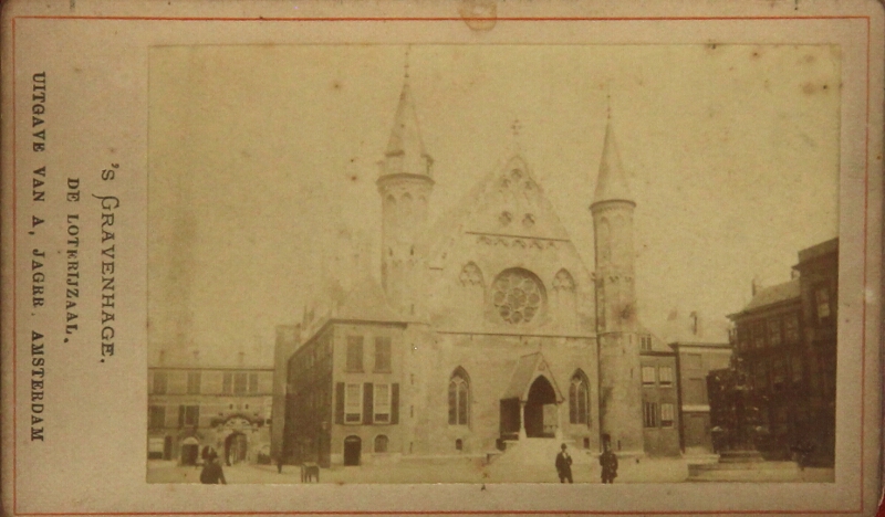
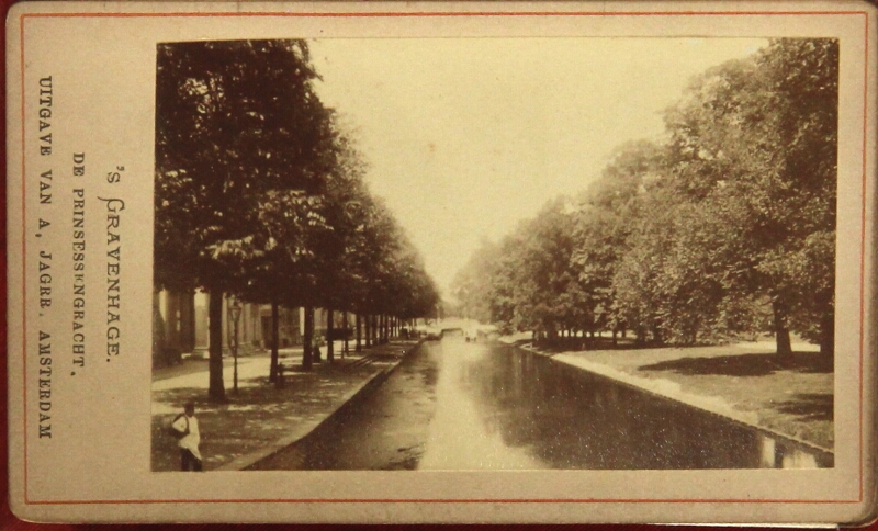
132. La Haye [cover title]. Amsterdam: uitgave van A. Jagrr, n.d., [ca. 1880s].
$125
32mo (approx. 4½" x 3"), accordion-fold view book with 12 mounted albumen photographs, each captioned and within a red-ruled border (one caption defective but not touching the print), including views of 's Gravenhage and Schveingen; original red cloth stamped in gilt and black; covers a ittle dull and the photographs slightly toned; good and sound, or better.
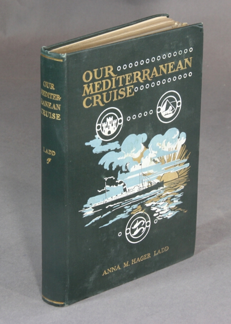
133. Our Mediterranean cruise by steamer "New England" in 1900. Chicago: R.R. Donnelley & Sons, 1902.
$35
8vo, pp. [2], 214; frontispiece portrait, plates, original blue cloth decorated in gilt, light blue and white, spine lettered in gilt; light wear to cloth, tiny white specks to heel of spine, gift inscription to front free endpaper, still a very good copy.
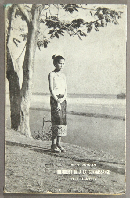
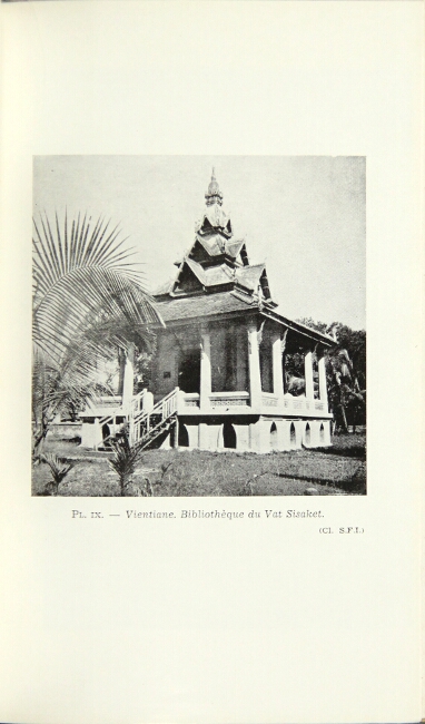
134. [Laos.] Introduction à la connaissance du Laos . [Saigon: Imprimerie française d'Outre-Mer, 1952.]
$75
First edition, 8vo, pp. 140; 18 photographic illustrations on rectos and versos of 9 plates; folding map; very good copy in original printed wrappers, and dust jacket.
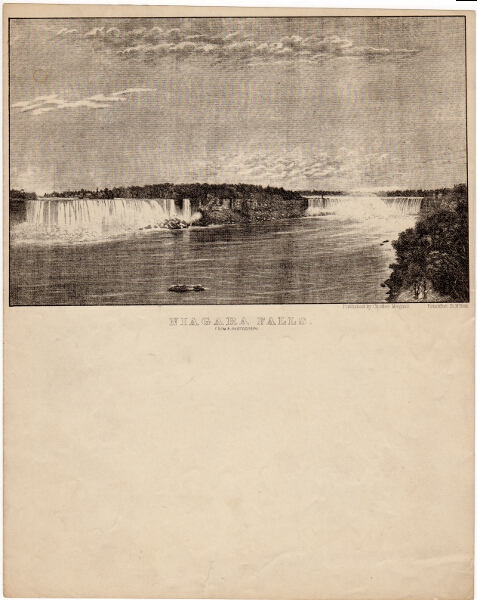
135. [Letter Sheet.] Niagara Falls. From a photograph. New York: Charles Magnus, n.d., (ca. 1875?).
$125
Approx. 10½" x 8¼", the image being approx. 5" x 8". One small tear in the bottom margin, else a very good example.
Charles Magnus was a print publisher, map dealer, bookseller and stationer working in New York City from 1850 to 1899 who issued over a thousand different letter sheets, maps, song sheets, envelopes, and separate prints. His best known works were city views and Civil War related material. Much of his work was copied from other printmakers. He often altered or combined design elements from several sources, rarely crediting the original artist. Many of his works after 1865 were based on photographs, which he often altered, drawing in figures or re-drawing lines for clearer reproduction (Winterthur website).
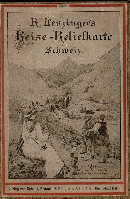
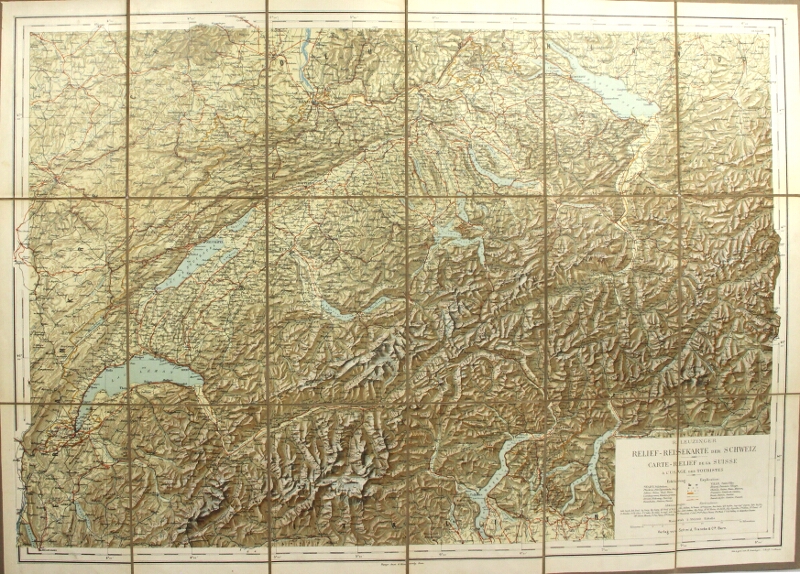
136. Relief Reisekarte der Schweiz / Catre-releif de la Suisse a l'ugage des touristeds. Bern: Verlag von Schmid, Francke & Cie., n.d., [ca. 1890s].
$75
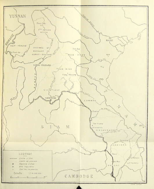
Approx. 21" x 30" folding down to 7½" x 5", relief map printed in color, printed paper labels in German and French; one short split at a fold, otherwise very good and clean.
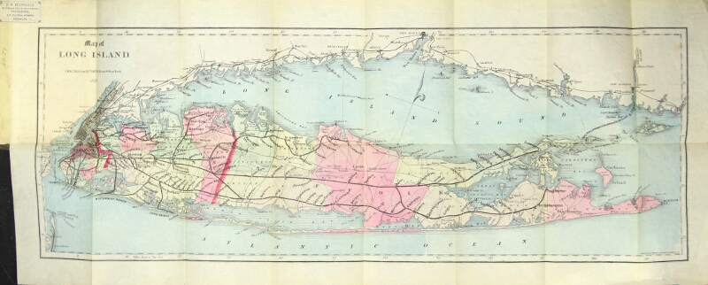
137. [Long Island.] Map of Long Island. New York: G. W. & C. B. Colton, 1884.
$950
Hand-colored pocket map approx. 9" x 22½" folding down into the original brown cloth covers lettered in gilt; hinges cracked, some minor discoloration to the cloth; map is fine.
A smaller version of that issued by Colton in 1882.
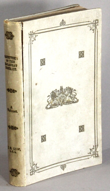
138. Balaghat District. Volume A. Descriptive. Allahabad: printed at the Pioneer Press, 1907.
$350
First edition, 8vo, pp. iv, [5], viii-xviii, [2], 334; 2 double-page maps printed in color, folding photolithograph plate, and 14 other plates largely from photographs; title page loosening and a little browned, verso of front free endpaper also browned; front joint cracked, all else good or better in original white gilt-stamped parchment - possibly a presentation binding (see below).
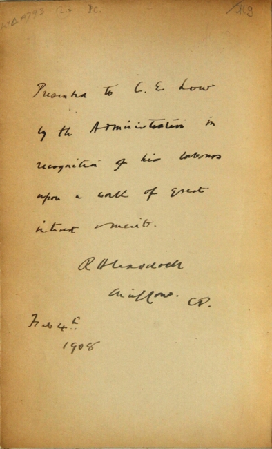
This is the author's own copy, and bears a presentation to him on the verso of the front free endpaper reading: "Presented to C. E. Low by the Administration in recognition of his labours upon a work of great interesrt & merit. R. H. Craddoch (?) Feb. 4, 1908."
Published in the Central Provinces Distric Gazetteers series. Includes a general description of Balaghat (geology, botany, flora, etc.), and sections on history, archaeology, population, religion, agriculture, manufactures and commerce, forests and minerals, famine, and land administration.
Volume B. (Statistical Tables and Addenda) was also apparently published, but no record found in OCLC. Of Volume A., 8 in OCLC, and only Cleveland Public in the U.S.
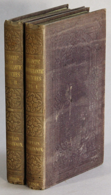
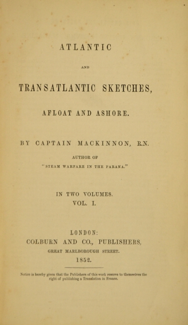
139. Atlantic and transatlantic sketches, afloat and ashore. London: Colburn & Co., 1852.
$750
First edition, 2 volumes, 8vo, pp. x, x*-xi*, 288, 16 (ads); ix, [1], 292, 24, [2] ads; original brown blindstamped cloth, gilt lettering on spine; spines slightly faded, else near fine.
British naval captain's observations on America (he traveled extensively along the east coast, and west through upstate New York, Michigan, Illinois and Wisconsin) and containing remarks on the Mormons and Mormon poetry; other sections on The Falkland Islands, a hurricane in Antigua, and the pirate, Captain Kidd.
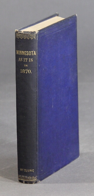
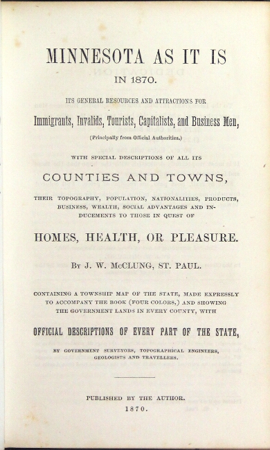
Buck 475; Flake 5214; Sabin 43461.
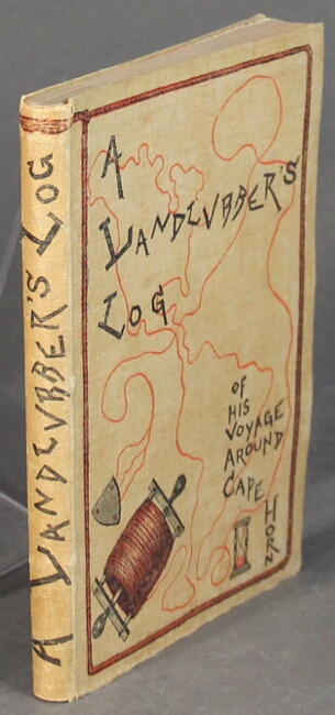
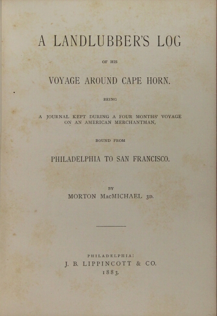
140. A landlubber's log of his voyage around Cape Horn. Being a journal kept during a four months' voyage on an American merchantman, bound from Philadelphia to San Francisco.. Philadelphia: J. B. Lippincott & Co., 1883.
$150
First published edition, sm. thin 8vo, pp. 150, [6] ads; original pictorial tan cloth decorated in black and red, frontispiece map, deck plan of the ship in text, minor foxing throughout, very good or better copy.
Morton (1857-1919) was from Philadelphia and was the son of that city's mayor (1866-1869).

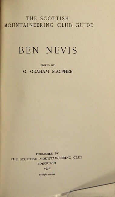
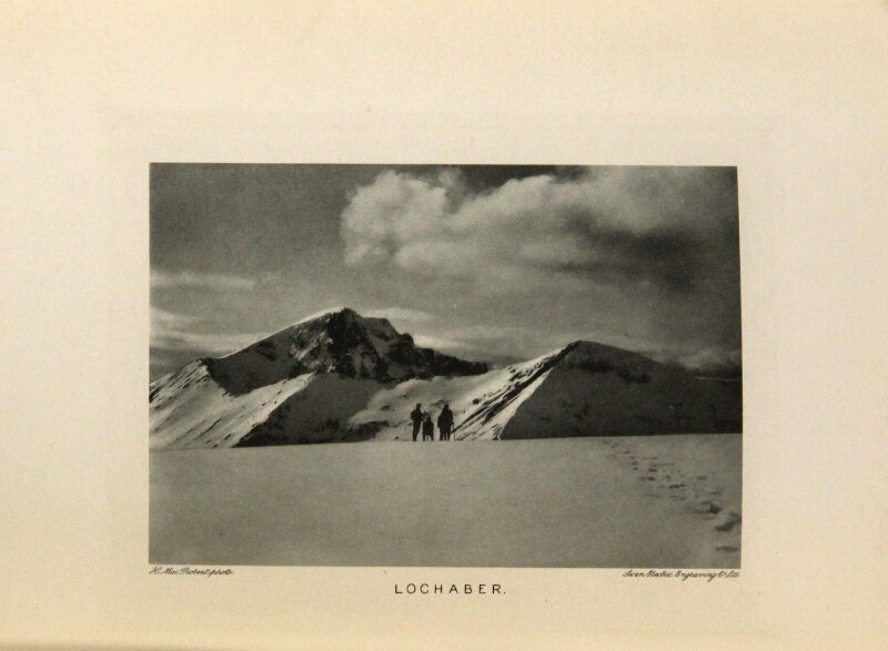
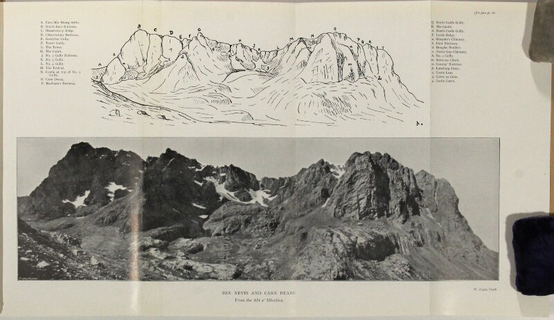
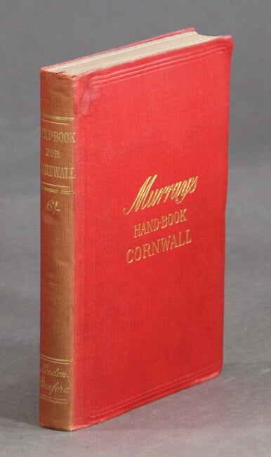
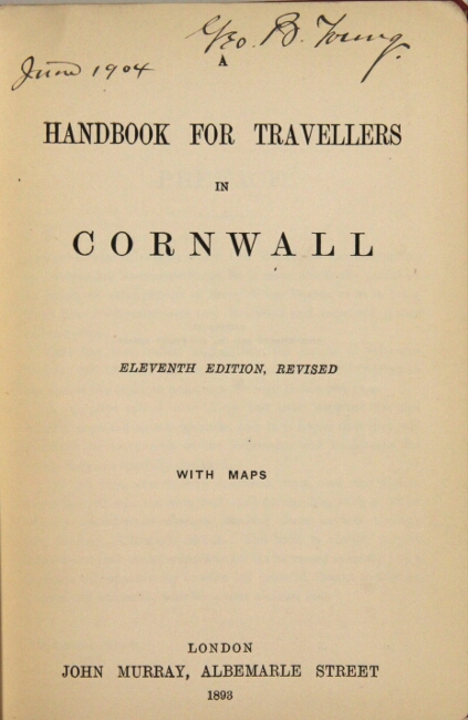
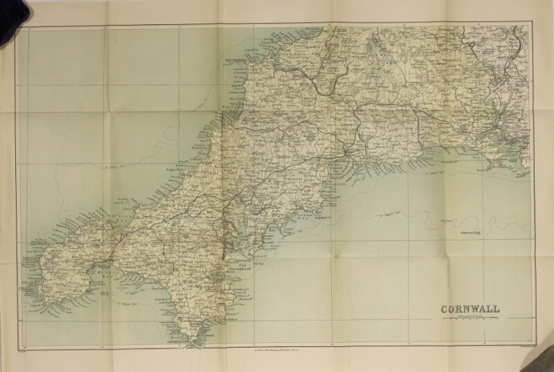
141. Ben Nevis. The Scottish Mountaineering Club guide. Edinburgh: The Scottish Mountaineering Club, 1936.
$85
First edition thus, 8vo, pp. vi, [2], 101; photogravure frontispiece showing "Lochaber," 24 illustrations on 16 plates, and 9 folding panoramas; covers very slightly bowed and some spotting to top edges, else very good in somewhat rubbed and soiled jacket with a few tears and losses along edges.
This copy with "Warning to Hill Walkers" tipped on to front free endpaper. Consisting of two parts: the first being a description of the Ben and including observations on weather conditions, flora and fauna, and geologic makeup; the second being descriptions of routes for ascending the Ben, with notes rating the difficulty of each.
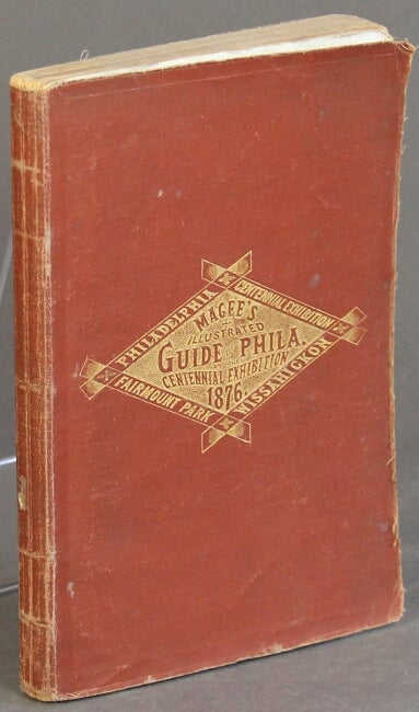
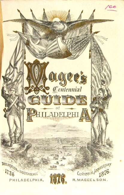
142. Magee's illustrated guide of Philadelphia and the Centennial exhibition, a guide and description to all places of interest in or about Philadelphia, to the Centennial grounds and buildings, and Fairmount Park. Philadelphia: Richard Magee & Son, 1876.
$100
First edition, 8vo, pp. [6], 192, [10] ads; 3 folding maps (1 with 4" tear but no loss); 5 plates (1 in color, 4 double-p.), wood-engraved illustrations throughout (some full-p.); original limp terracotta cloth stamped in gilt on upper cover; front and back free endpapers excised, edges a little worn, else a very good copy. In this issue the copyright notice is on the title page and the verso of the title contains what in other issues is the frontispiece.

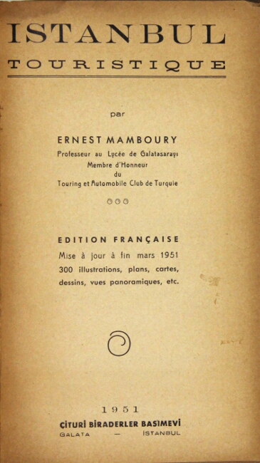
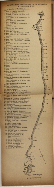
143. Istanbul touristique ... Edition française. Istanbul: Cituri Biraderler Basimevi, 1951.
$85
First edition, 8vo, pp. 630, [2]; 4 folding maps (1 loose), illustrated throughout with approx. 300 maps, plans, and views; pages browning else a good copy or better in original pictorial gray cloth stamped in black on both covers and spine, adverts on endpapers. Includes bibliographical references (p. 608-615).
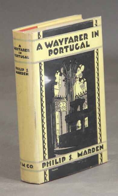
144. A wayfarer in Portugal. Boston: Houghton Mifflin Company, 1927.
$45
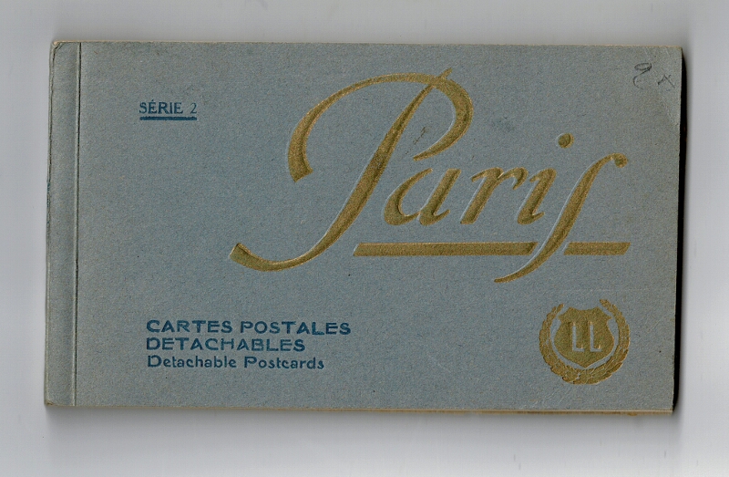
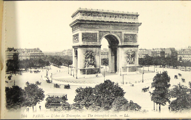
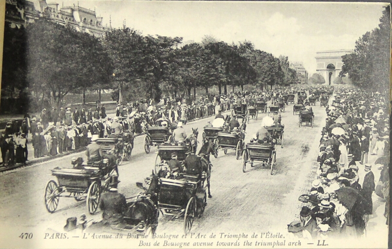
First edition, small 8vo, pp. x, [2], 210, [2]; map endpapers, 26 illus. on 20 plates; a fine copy in a very slightly soiled, price-clipped dust-jacket.
"Practical assistance to those who would venture into a country unspoiled by tourists" (jacket blurb).
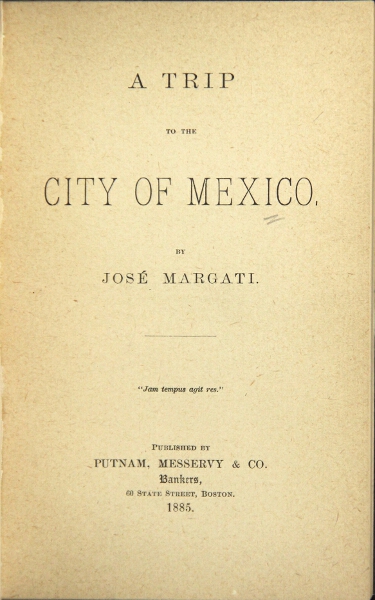
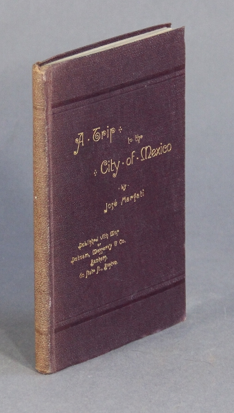
145. A trip to the city of Mexico. Boston: Putnam, Messervy & Co, Bankers, 1885.
$250
First edition, slim 12mo., pp. [3], 88; large folding map printed in color at the back; pages toned, spine slightly discolored, else a very good copy in original limp brown cloth, lettered in gilt on upper cover.
A party of 30 (mostly Bostonians) on the Mexican Central Excursion. "This story ... is made up largely from private memoranda which were made day after day ... to make it as complete a record of that delightful excursion as possible" (preface).
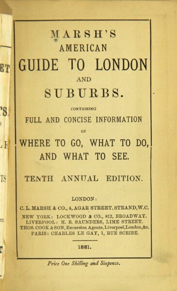

146. Marsh's American guide to London and its suburbs. Containing full and concise information of where to go, what to do, and what to see. Tenth annual edition. London: C. L. Marsh & Co.; New York: Lockwood & Co., 1881.
$65
16mo, pp. iii ads, [4], 170, iv-xvi (ads); endpapers included in pagination; folding frontispiece railway map (short tear along one fold) with routes and rates on verso; ex-MHS with old call sticker at base of spine and society bookplate, otherwise a very good, sound, bright copy in original blue cloth stamped in gilt on upper cover and spine.
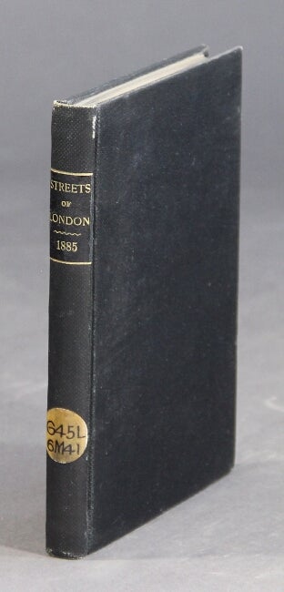
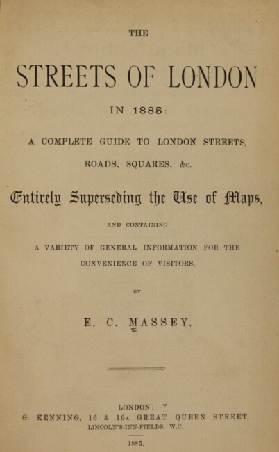
147. The streets of London in 1885. A complete guide to London streets, roads, squares, &c entirely superseding the use of maps, and containing a variety of general information for the convenience of visitors. London: G. Kenning, 1885.
$75
First edition, 12mo, pp. [4], 175, xxxi; 4 pp. ads on blue paper inserted at p. 96; ex-library, otherwise a very good, sound copy in original black cloth, spine gilt. An interesting guide giving "the best routes from leading streets to those which are less known."
148. Books for the traveler at home and abroad. New York: McBride Books, n.d. [ca., 1922].
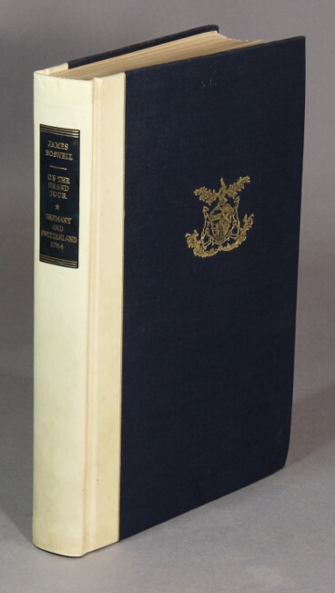
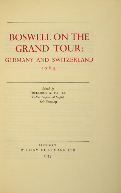
$35
8vo, pp. 32; double-p. world map, illustrated throughout; color pictorial wrappers; fine. Includes guide books, Europe on $2 a day, and Ponting's The Great White South.
149. Minnesota as it is in 1870. Its general resources and attractions for immigrants, invalids, tourists, capitalists and business men ... with special descriptions of all its counties and towns. [St. Paul: Published by the author, 1870.
$100
First edition, 12mo, 24pp. ads preceding title, pp. 299, [1], [44] ads; 5 full-page illustrations in the text, this copy without the map which was available separately only to original purchasers who desired to have it; a very good copy in original blue cloth gilt. Interesting adverts, numerous statistical tables, etc. Howes M-47.
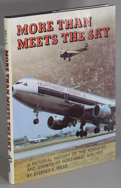
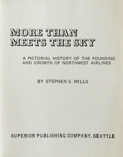
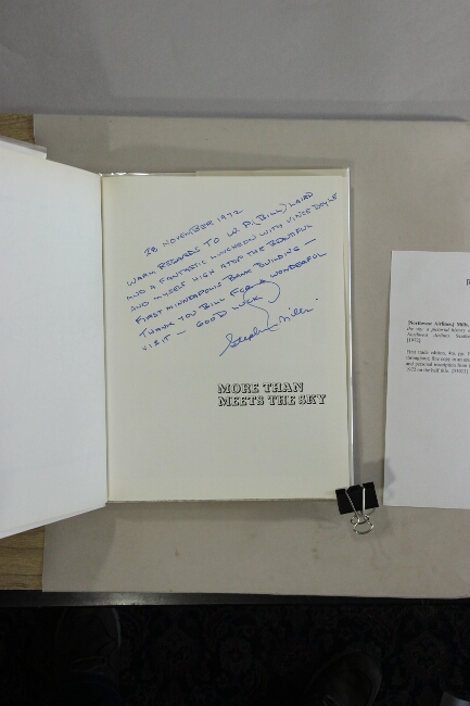
150. More than meets the sky: a pictorial history of the founding and growth of Northwest Airlines. Seattle: Superior Publishing Co., [1972].
$75
First trade edition, 4to, pp. 192; map endpapers; illustrated throughout; fine copy in an unclipped dust jacket. With a long and personal inscription from the author dated November 28, 1972 on the half title.
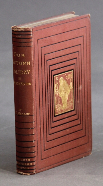
151. Our autumn holiday on French rivers. Boston: Roberts Bros., 1879.
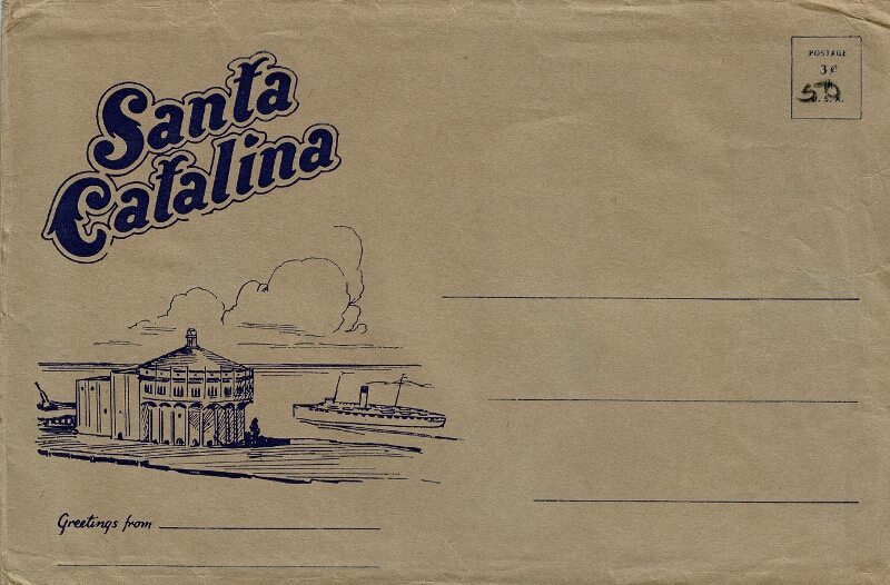
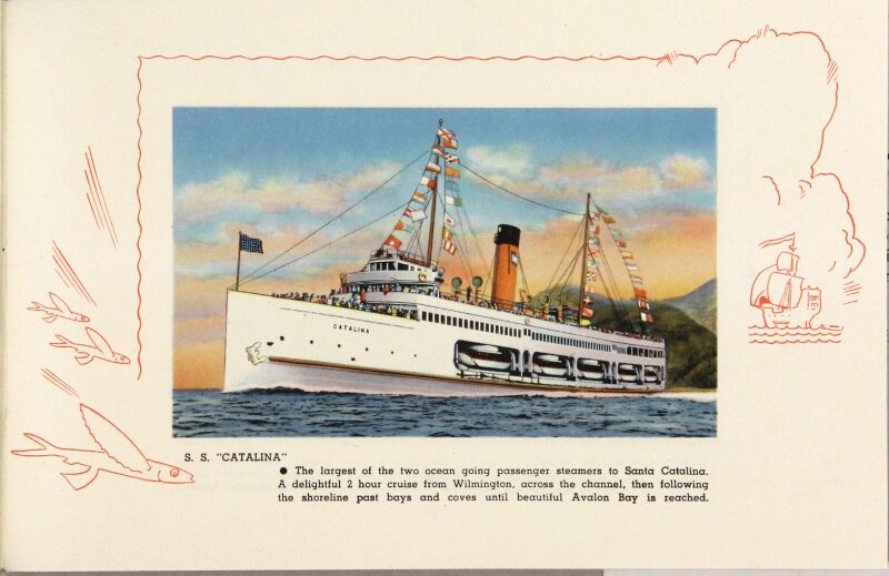
$75
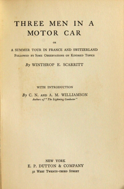
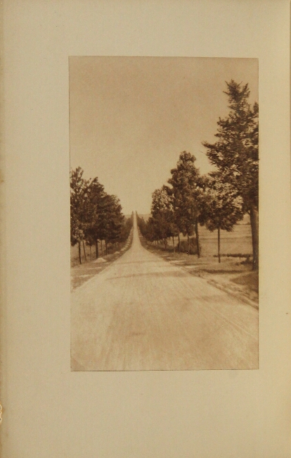
First edition, 12mo, pp. xii, 321, [2] ads; pictorial title page; extremities rubbed, else a very good copy in original pictorial terracotta cloth stamped in gilt and black on upper cover and spine.
Not in American Travellers Abroad.
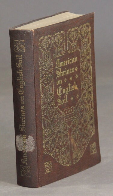
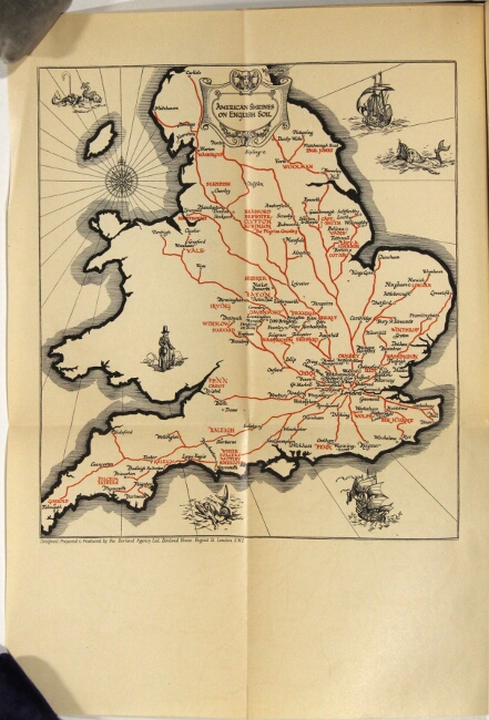
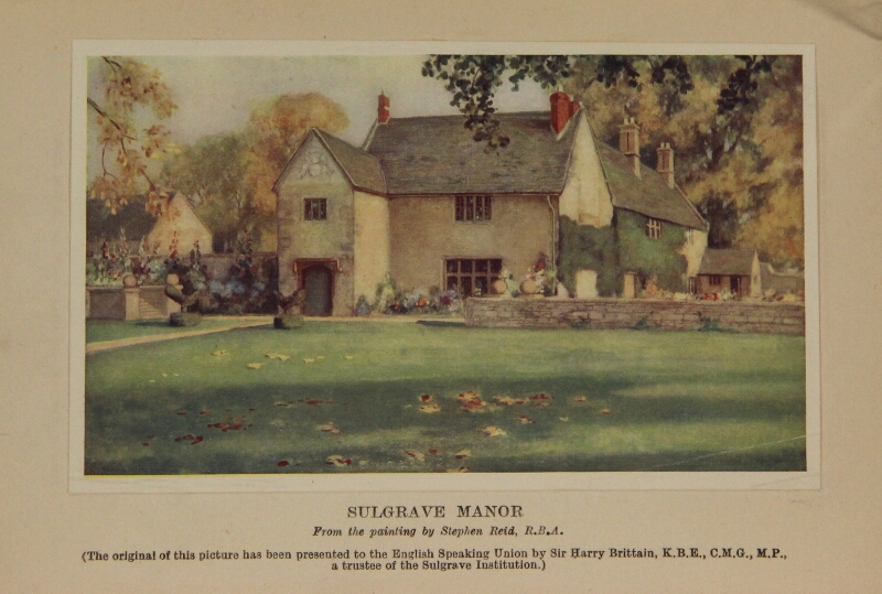
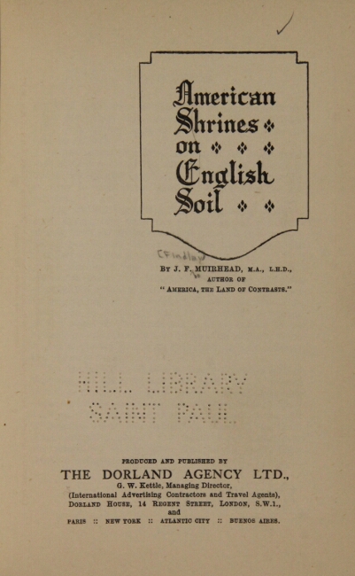
152. American shrines on English soil. London: The Dorland Agency, n.d., [ca. 1924].
$50
First edition, 8vo, pp. x, [4], 190; 20 plates (1 in color), 1 folding map of England, illustrations throughout text; ex-library copy with sticker removed from spine and perforation in title-p., slight rubbing on covers, else very good or better in original brown cloth, gilt-stamped on spine and upper cover.
This guide sets forth "particulars of those places in [England] which are closely linked with the history and the foundations of the American Commonwealth" (foreword). Shrines of notable Americans, including Washington, Lincoln, Franklin, the Pilgrims, Revolutionary leaders, and writers and artists such as Hawthorne, James, Whistler and Reynolds. Organized by county.
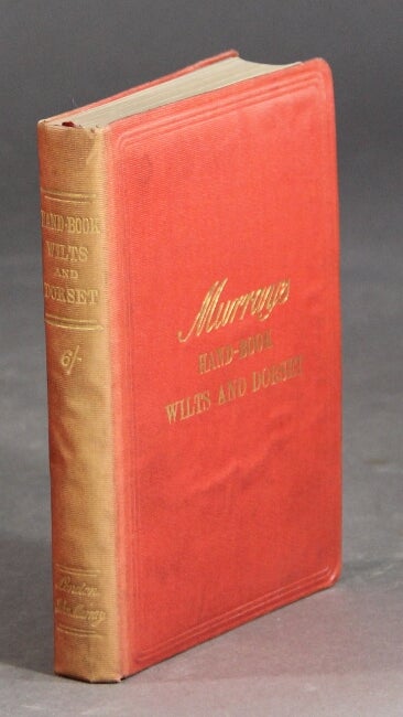
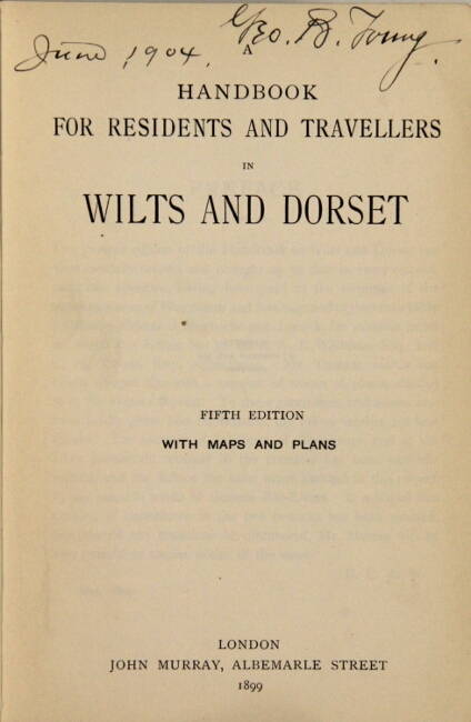
153. A handbook for residents and travellers in Wilts and Dorset. Fifth edition with maps and plans. London: John Murray, 1899.
$65
12mo, pp. xlvii, [1] p., 698 columns, 701-712; ads on blue-coated endpapers; 2 folding color maps in cover pockets, 4 folding color maps, plus several plans in the text; spine a little sunned, else very good in original red cloth gilt-lettered direct on upper cover and spine.
154. A handbook for travellers in Cornwall. Eleventh edition revised. London: John Murray, 1893.
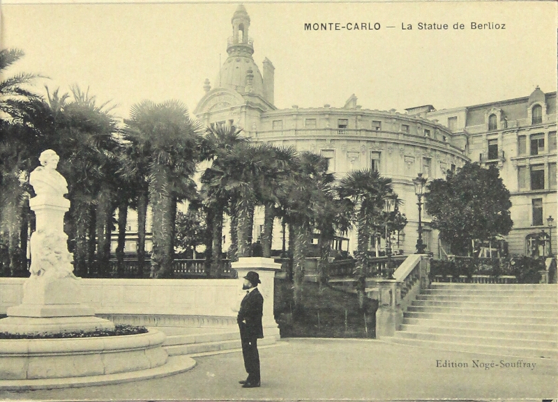
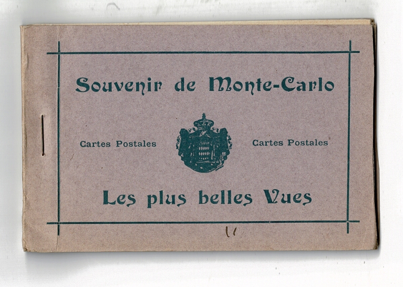
$75
12mo, pp. 51, [1], 181, [1], 48 (Murray's Handbook Advertiser, 1901-1902, so clearly a late issue), containing useful information for travellers, railway and steamboat companies, hotels, and miscellaneous advertisements); ads on blue-coated endpapers; folding color map in pocket; 6 color maps (4 folding); spine lightly sunned, but generally a very good copy in original red cloth, gilt-lettered direct on spine and upper cover.
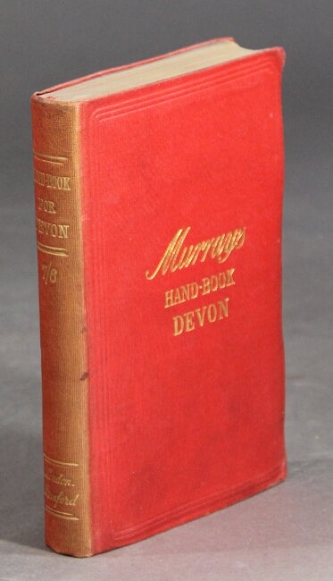
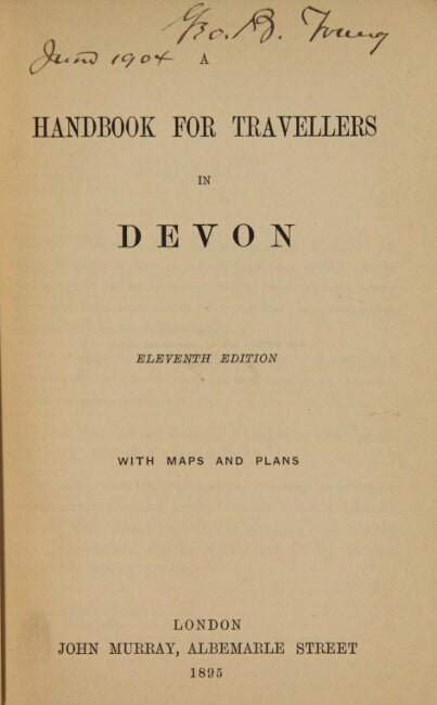
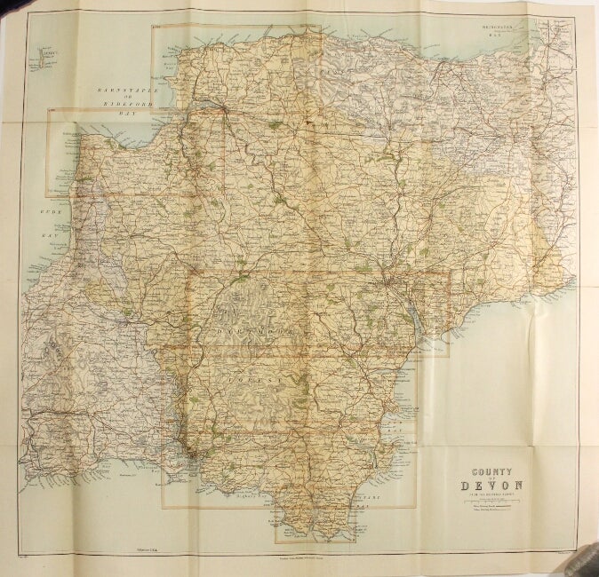
155. A handbook for travellers in Devon. Eleventh edition. With maps and plan. London: John Murray, 1895.
$75
12mo, pp. 41, [1], 291, [1], 16 (index), 52 (Murray's Handbook Advertiser, 1903-1904, so clearly a late issue), containing useful information for travellers, railway and steamboat companies, hotels, and miscellaneous advertisements; ads on blue-coated endpapers; folding color maps in cover pockets, 10 color maps (9 folding), plus 1 plan; spine a little sunned, Murray's Handbook Advertiser browned, else near fine in original red cloth gilt-lettered direct on upper cover and spine.
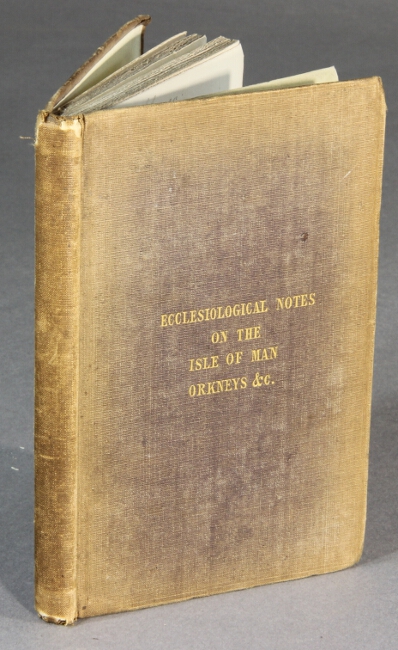
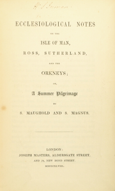
156. Ecclesiological notes on the Isle of Man, Ross, Sutherland, and the Orkneys; or, a summer pilgrimage to S. Maughold and S. Magnus. London: Joseph Masters, 1848.
$450
First edition, 16mo., pp. vi, [2] 118, 2 (ads), 36 (publisher's catalogue); errata slip tipped in at page 118, 2 full-page plans of cathedrals in the text, plus a few other illustrations; occasional early ink annotations in the margins; slight chipping at spine ends, spine and edges a little discolored, otherwise a good, sound copy in original brown cloth, gilt lettered on the upper cover. [Note: this photograph makes the discoloration look worse than it actually is.]
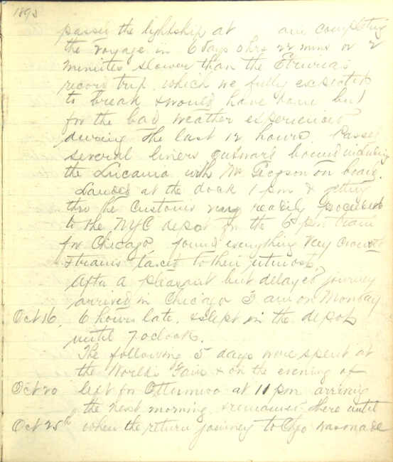

157. [New Zealand.] Manuscript diary of a journey to New Zealand and other far-away places. N.p., n.d.: [at sea, on the road,, 1893-94].
$1,250
4to, pp. [82]; Liverpool stationer's label on paste-down, edges marbled, extremities a bit rubbed, else a very good copy in black limp morocco. Laid in are approx. 20 octavo manuscript leaves from an unknown American women's diary dated October 1887 - August 1891. A lively account of a voyage around the world, with some interesting details of travel in the United States, Australia, Tasmania, and Hawaii, but primarily covering New Zealand.
The author, presumably an American man (as per the style of dating, use of syntax, etc. -- and perhaps living in the England at the time) identified only as JHM, begins the journey from Liverpool bound for Chicago via New York, to spend several days at the Chicago World's Fair. He traveled on the Shaw, Savill & Albion steamer SS Tainui, stopping in Las Palmas (Canary Islands), Cape Town, and Hobart, and arriving in Wellington on January 9, 1894. He spent a month traveling around New Zealand by rail, steamer, and stage coach, and offers detailed commentary on the characteristics of transportation and accommodation (with many individual hotels mentioned), as well as the appearance and commercial activities of the principal towns. Includes a visit to Cable Bay telegraph station, with details on the method of transmission, detecting and repairing damage to the cables, etc. One of the most engaging sections describes a perilous (if beautiful) journey through Buller Gorge, as his party finds themselves at the mercy of a coach driver so reckless as to cause them to "consider the advisability of setting down until a railroad is built through this part of the country".
JHM then spends a week in Australia, traveling by rail from Melbourne ("the finest city in the Colonies") to Sydney (where "streets are generally narrow and running in all directions. Steam trains operate over different parts of the city, but they are noisy, dangerous and very objectionable."). He offers a detailed comparison of rail travel (size of track, type of cars, services available etc.) in Australia, England, and the United States.
The return journey takes him to Honolulu (arriving 4, March 1894), where he describes the quarantine (smallpox) and customs procedures (searching for guns and opium), and the air of political tension ("the Steam launches from the British and Americans in turn came alongside and a Lt. from each came on board, looked over the ship's papers, took some memos, and withdrew, all this being done with such an air of importance and authority--gave one the idea that surely something was up."). He also offers details on the Royal Hawaiian Hotel and the cultivation and preparation of taro root.
The final leg of the journey takes JHM through San Francisco, Salt Lake City, Colorado Springs, and Denver, but these are only briefly described.
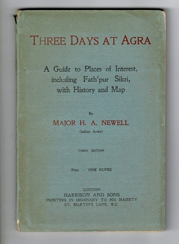
158. Three days at Agra. A guide to places of interest, including Fath'pur Sikri, with history and map ... Third edition. London: Harrison and Sons, n.d., [ca. 1915].
$45
12mo, pp. 76, [2]; folding map of Agra; original blue wrappers printed in red and black; minor loss at spine ends, else very good.
Includes a history of the city, a 3-day itinerary, and sections on arts and crafts and Akbar, the great Moghul.
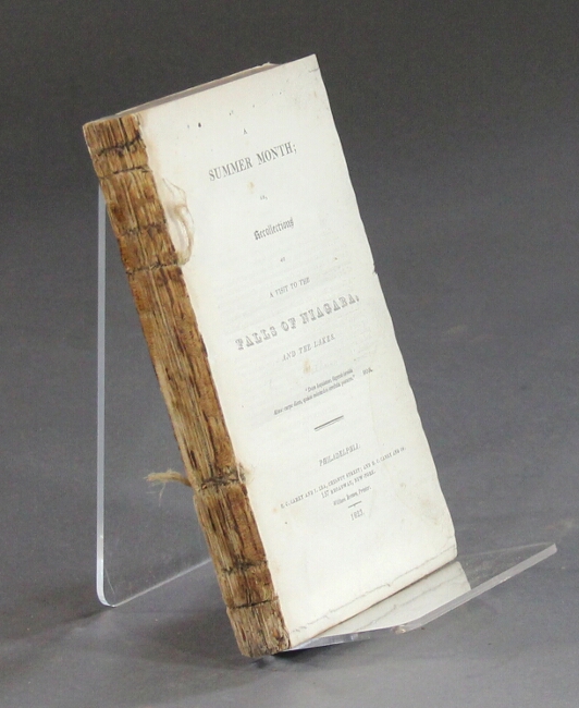
159. [Niagara Falls.] A summer month; or, recollections of a visit to the falls of Niagara, and the lakes. Philadelphia: H. C. Carey and I. Lea, Chestnut Street; and H. C. Carey and Co., 157 Broadway, New York, 1823.
$125
12mo, pp. [iii]-vii, [1], 250; removed from binding, and without the half-title; textblock very good and sound.
Dow notes the author as a Mr. Mathews, without a given name.
American Imprints 14240; Dow, Anthology and bibliography of Niagara Falls, I, p. 162; Sabin 93615; TPL 1263.
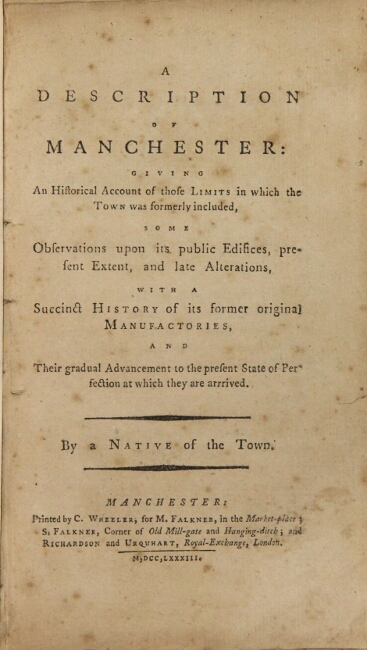
160. A description of Manchester: giving an historical account of those limits in which the town was formerly included, some observations upon its public edifices, present extent, and late alterations, with a succinct history of its former original manufactories, and their gradual advancement to the present state of perfection at which they are arrived. By a native of the town. Manchester: printed by C. Wheeler, for M. Falkner, in the Market-place; S. Falkner, Corner of Old Mill-gate and Hanging-ditch; and Richardson and Urquhart, Royal-Exchange, London, 1783.
$325
12mo, pp. 94, [2]; uncut; contemporary marbled boards, old vellum shelfback; boards rubbed and bumped, light foxing to title page and margins; good and sound.
Apparently, the first guide to Manchester. Stab holes evident in the gutter indicative of rebinding, and likely 20th-century endpapers.
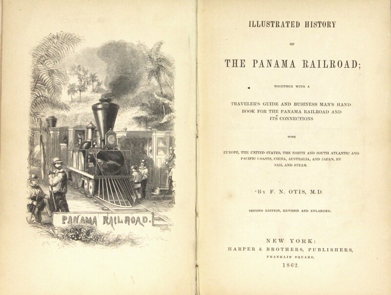
161. Illustrated history of the Panama Railroad; together with a traveler's guide and business man's hand book for the Panama Railroad and its connections with Europe, the United States, the North and South Atlantic and Pacific coasts, China, Australia, and Japan, by sail and steam ... Second edition, revised and enlarged. New York: Harper & Brothers, 1862.
$150
12mo, pp. 273, [3]; 33 wood-engraved text illustrations, most full page; original blindstamped blue cloth, gilt title on spine; spine slightly cocked, light rubbing and a few spots on cover, text clean and sound. Presentation copy to "Miss G. K. Otis, with affectionate regards of her brother, the author, N.Y. Aug. '64."
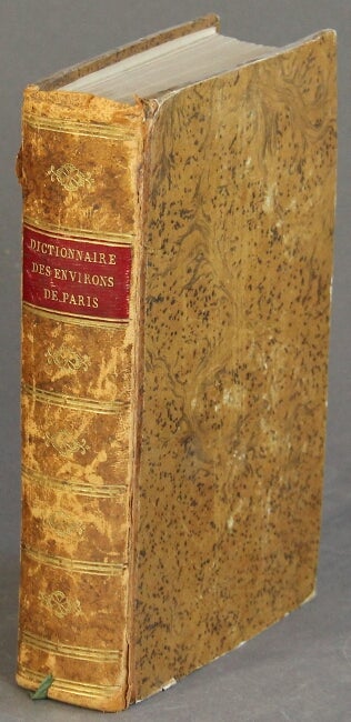
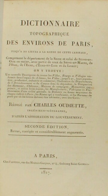
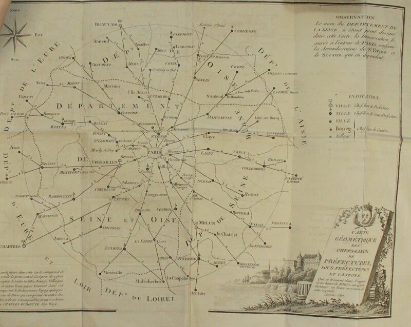
162. Dictionnarie topographique des environs de Paris…. Paris: chez l'auteur, 1817.
$250
Second edition, 8vo, pp. vii, [1], 698; folding copper-engraved map; contemporary calf-backed paper boards stylized to represent tree calf, red morocco spine label, spine gilt; extremities a little rubbed, hinges just starting, short tear to map with unobtrusive tape repair to verso, still a very good, sound copy.
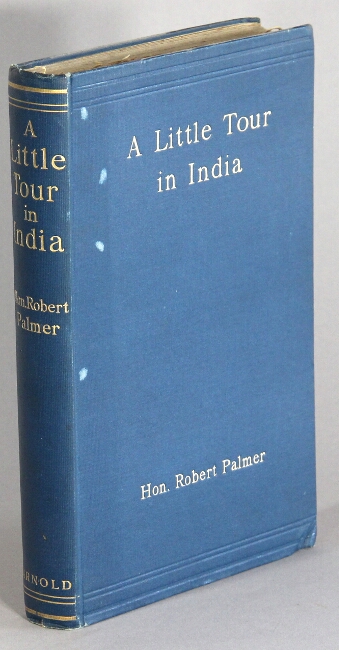
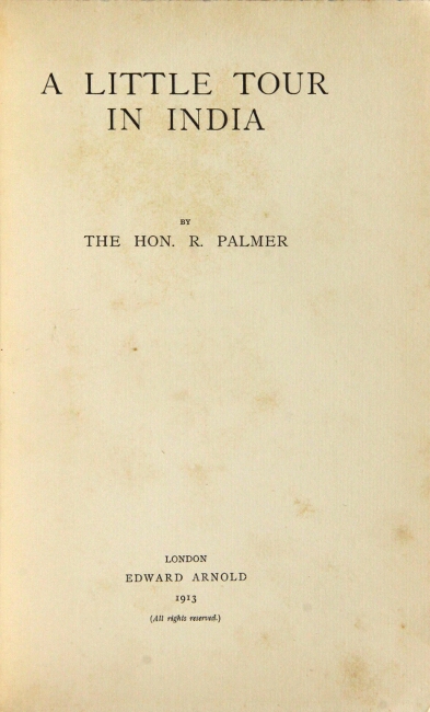
163. A little tour in India. London: Edward Arnold, 1913.
$75
First edition, 8vo, pp. xi, [1], 224, 16 (ads); original gilt-lettered blue cloth; corners bumped, a few small white spots to cloth, gift inscription and a bit of discoloration to front free-endpaper, else a very good, partially unopened copy.
Entertaining letters from a young man to his family on his first visit to India.
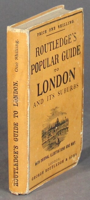
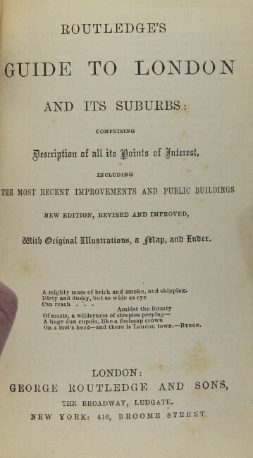
164. Routledge's guide to London and its suburbs: comprising descriptions of all its points of interest, including the most recent improvements and public buildings. London & New York: George Routledge & Sons, n.d., [ca. 1880's].
$125
Small 8vo, pp. [8], 202, [6]; 6 pages of ads on endpapers; folding frontispiece map of London; numerous wood-engraved illustrations on 16 plates; very good, sound copy in original printed orange boards, slightly rubbed at extremities, and with a tiny loss at the lower corner of the front board.
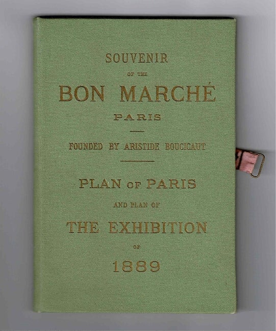
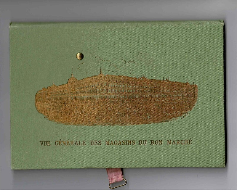
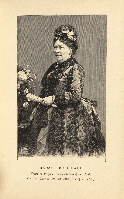
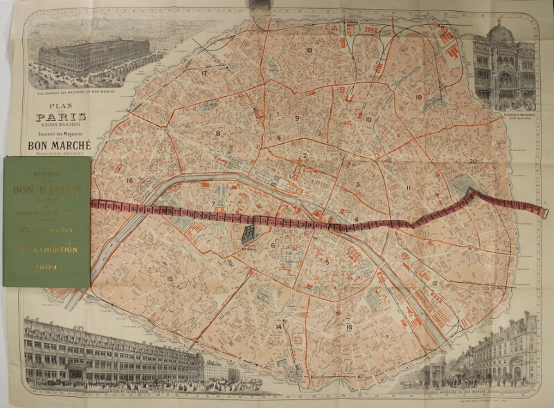
165. [Paris Exhibition.] Souvenir of the Bon Marche Paris. Founded by Aristide Boucicaut. Plan of Paris and plan of the Exhibition of 1889 [cover title]. [Paris: printed by E. Plon, Nourrit & Co., n.d., ca. 1889.]
$225
16mo, pp. 64; contents leaf mounted (as issued) on the verso of the front free endpaper; 2 portraits, 3 wood-engravings (1 double-page); tables in the text corresponding to a large color folding map of Paris to which is attached a pink ribbon (riveted through to the back cover) keyed with numbers (1-74) corresponding to the tables for the easy location of streets, buildings, quays, etc.; the verso of the ribbon is printed with an advertisement for the Bon Marche; original pictorial green cloth stamped in gilt on both covers; fine.
166. Paris. Cartes postales detachables. Serie 2 [wrapper title]. [Paris: Levy fils & cie, n.d., ca. 1912?].
$50
Booklet (approx. 3½" x 5¾") containing 20 photographic postcards interleaved with tissue guards; original printed blue-gray wrappers embossed in gilt; near fine.
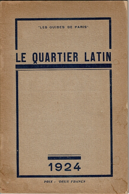
167. [Paris.] Le quartier Latin. Paris: Georges Saulgeot, 1924.
$30
8vo, pp. 64; double-page map, 2 plates, illustrations in text, including illustrated adverts; original printed brown wrappers; some toning of the text; very good.
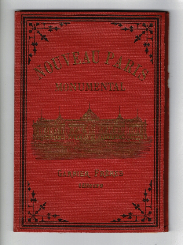
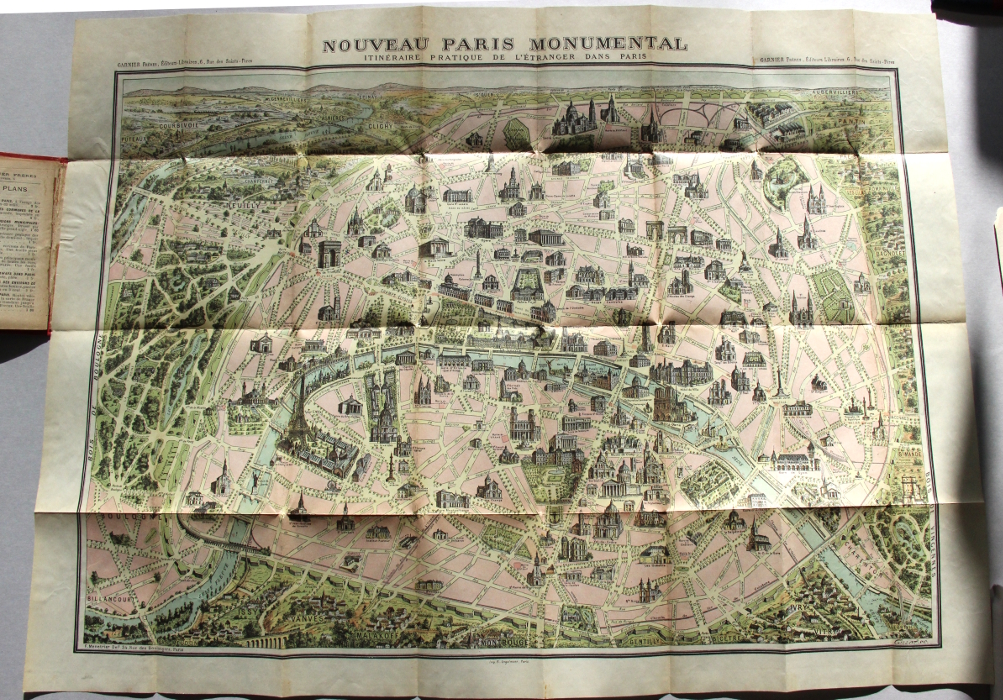
168. [Paris.] Nouveau Paris monumental [cover title] . Paris: Garnier Freres, n.d., ca. 1900..
$85
Folding color lithograph map approx. 22" x 30" showing the monuments, cathedrals, and other sights of the city; folding down into a 16mo red cloth binding lettered in gilt; binding a little rubbed; the map is fine, with no breaks at the folds.
Tipped to the front pastedown is a 9-page printed key to the map, the last 8 pages of which are separated, but present, with an old tape stain in the gutter.
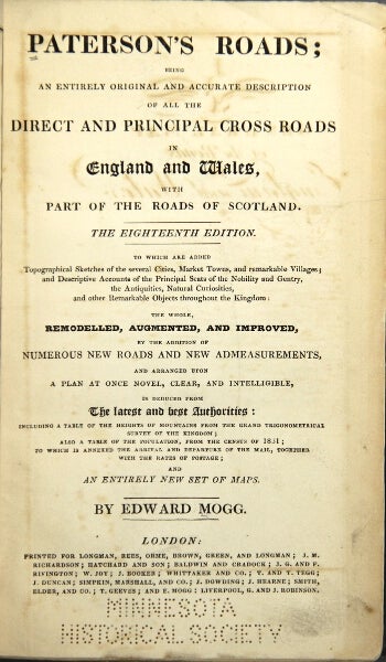
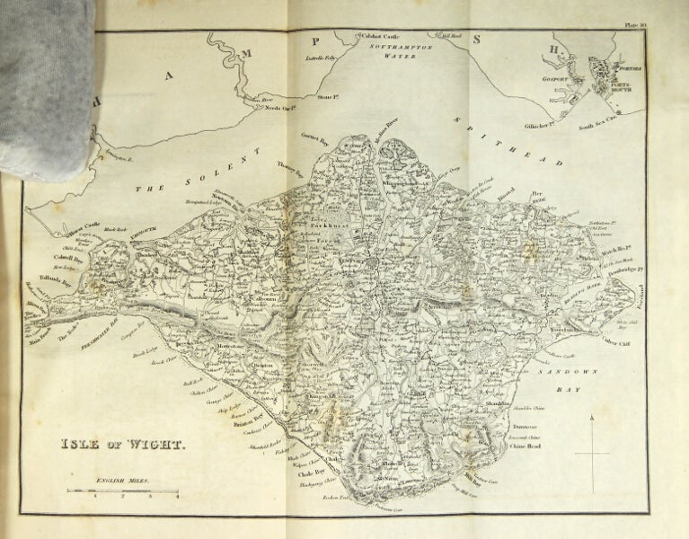
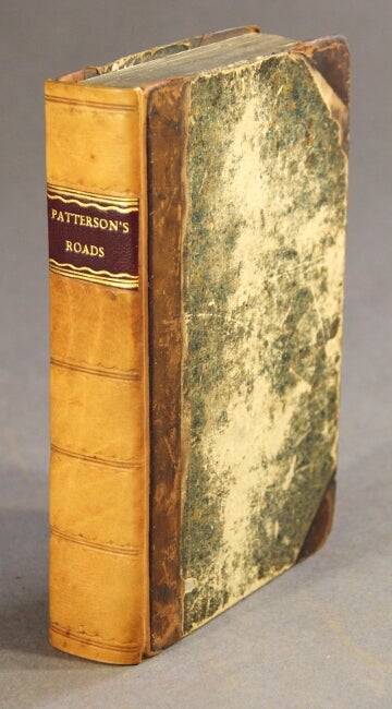
169. Paterson's roads; being an entirely original and accurate description of all the direct and principal cross roads in England and Wales, with part of the roads of Scotland. The eighteenth edition. To which are added topographical sketches of the several cities ... and descriptive accounts of the principal seats of the nobility and ... the antiquities ... throughout the kingdom: the whole remodelled, augmented and improved ... with an entirely new set of maps.. London: Longman, Rees, Orme [et al.], n.d., [1829-32].
$500
Thick 8vo, pp. 6, *6, [7]-82, 715; large folding frontispiece map and 10 maps on 7 folding plates at the back; bound with: Appendix to the eighteenth edition, [London, 1828], pp. iv, [2], 44; frontispiece map; original green cloth, rebacked with original printed paper label laid down; ex-MHS with perforated stamp at the bottom of the title page (not touching the imprint), and the MHS bookplate marked withdrawn.
Originally published as A New and Accurate Description of all the Direct and Principal Cross Roads in Great Britain in 1771 (later, Paterson's British Itinerary), this is the final revision of the book (published in successively in 1826, 1828, and in undated issues in 1829 and 1832), and its largest and most complete text.
For a good history of this famous guide book see Herbert Fordham's article in the Transactions of the Bibliographical Society, The Library, Vol. 5, 1924-5, pp. 333ff.
170. A new and accurate description of all the direct and principal cross roads in Great-Britain. Containing the direct roads from London to all the cities, the borough, market, and sea-port towns ... Twelfth edition: including the roads of Scotland
. London: printed for the proprietor and sold by Messrs Longman and Rees, n.d., [1799].
$200
8vo, pp. xvi, 702 columns, [1] advertisement, pp. 704-759, lxii; signature 2Z bound out of order, but the book is complete; 2 double-page engraved maps; contemporary quarter calf over marbled boards, neatly rebacked, red morocco label on spine; boards rubbed, but generally good and sound.
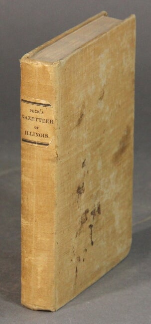
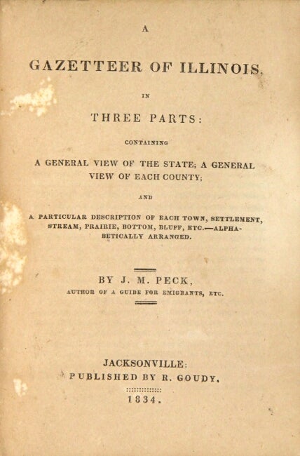
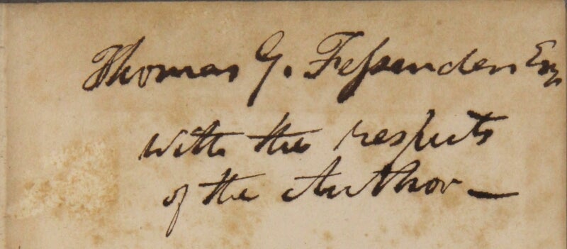
171. A gazetteer of Illinois, in three parts: containing a general view of the state; a general view of each county; and a particular description of each town, settlement, stream, prairie, bottom, bluff. etc. …. Jacksonville: published by R. Goudy, 1834.
$1,250
First edition, 12mo, pp. viii, 376; original pink moire cloth, printed paper label on spine; some spotting on the covers, otherwise a very good, sound copy.
This a presentation copy inscribed "Thomas G. Fessenden Esq. with the respects of the author." Fessenden, a native of New Hampshire, graduated from Dartmouth in 1796. After failed business ventures in London, he settled in Boston, and later in New York City where he edited the Weekly Inspector. By 1822 he was back in Boston where he founded and edited the New England Farmer. He also edited the Horticultural Register and the Silk Manual. In 1834 he published The Complete Farmer and Rural Economist.
The second appendix, on the "Wisconsin Territory" includes a bit on the Minnesota border country, the Mississippi River and the "North Western Territory." "Much of the information for this work was gathered as a result of Peck's extensive travel over the state and from personal interviews with citizens familiar with their counties of residence" (Byrd 191). Graff 3232; Howes P-170.
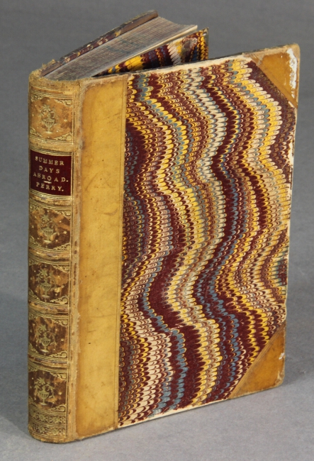
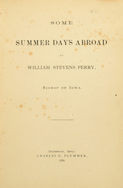
172. Some summer days abroad. Davenport, Iowa: Charles G. Plummer, 1880.
$100
First book edition, 16mo, pp. [6], 213; contemporary half polished tan calf, gilt-decorated spine, red morocco label; extremities rubbed; good and sound.
"These sketches ... are now re-issued from the columns of the daily and diocesan newspapers, where they originally appeared ... intended as a record of most happy and profitable days abroad, and ... an account of the second Lambeth Conference of Bishops in communion with the Church of England ... Such as they are, published as they were written, for the pleasure of the author and his friends..."
American Travellers Abroad, P-63.
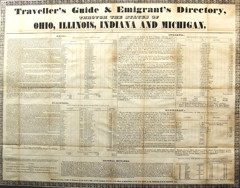
173. Traveller's guide & emigrant's directory, through the states of Ohio, Illinois, Indiana and Michigan. New York: H. Phelps & B. S. Squire, Jun., 1836.
$150
Broadside (approx. 17" x 22"), text in 5 columns beneath the running head, all within an ornate ornamental border; generally clean and with several neat old repairs on the verso at the folds; all else very good. The printer's imprint at the very bottom (and outside the ornamental border) of "James Van Norden, printer, 27 Pine-street, New-York" has been shaved, with loss.
While the broadside is separately recorded, it is sometimes found with Traveller's map of Michigan, Illinois Indiana & Ohio as published the same year by Humphrey Phelps. As is likely the case here: the broadside shows previous folds in 16ths and apparently was removed from a pocket-map binding.
Includes history, geography, "face of the country," products and manufactures, internal improvements, population, general remarks for emigrants, and price of passage from New York to various cities in the four states. Humphrey Phelps and Bela S. Squire were both New York City publishers at this time.
American Imprints 40583.

174. Philips' companion maps for tourists and travellers. Canada--West. With index. London and Liverpool: George Philip & Son, n.d. [after 1867].
$45
Color map showing "Dominion of Canada: Ontario & W. Quebec," measuring approx. 26" x 21"; linen-backed (as issued) and folding down to 8vo, original red cloth-covered boards ruled and lettered in black and gilt; cracks just beginning at crease junctions, the covers a bit soiled and worn; a good, sound copy. Lacking the original slipcase.
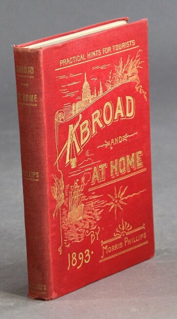
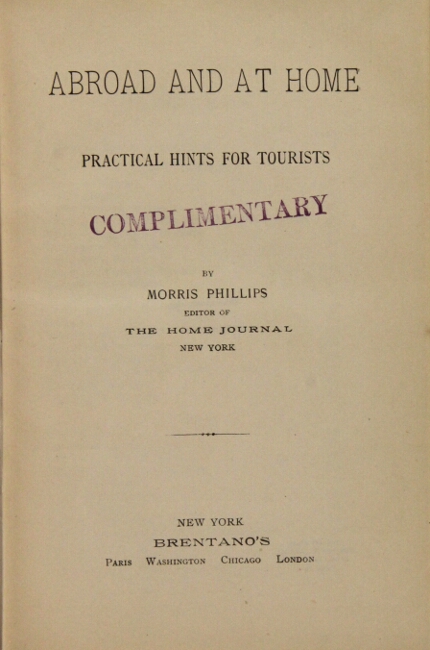
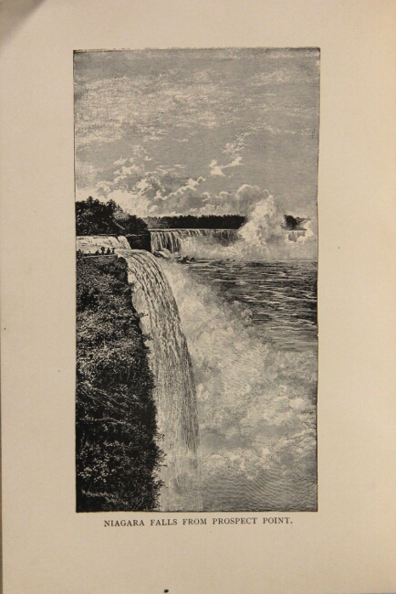
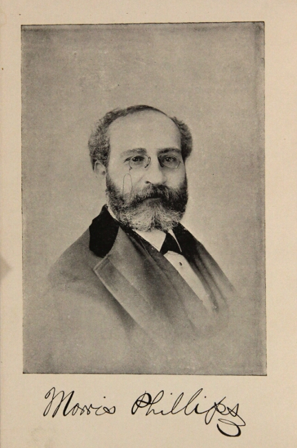
175. Abroad and at home practical hints for tourists. New York: Brentano's, 1893.
$45
12mo, pp. [12, ads], 365, [17, ads]; marbled edges, ads on endpapers, frontispiece portrait, plates, text illustrations; spine lightly sunned, cloth a bit bubbled; about very good. Publisher's complimentary stamp on title page.
Great Britain, Paris, Italy, Switzerland, and parts of the U.S. including Georgia, Florida, California, Salt Lake City, Adirondack mountains, etc., with summer and winter resort guides.

176. Picturesque Philippines the pearl of the orient. [Manila?: publisher not identified, n.d., ca. 1915].
$75
Oblong 12mo, approx. 4¾" x 7½", 16 chromolithographs string-bound in original brown pictorial wrappers; no text; gouge in the upper wrapper and affecting the blank margins only on the first 8 plates; all else good and clean.
Not found in OCLC.
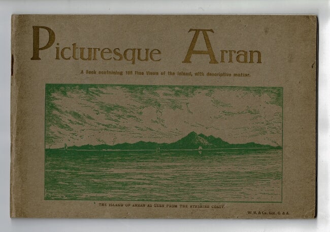
177. Picturesque views of Arran: a book containing 108 fine views of the island, with descriptive matter. [Glasgow: William Holmes & Co. Ltd., 1888].
$75
Oblong 4to, 48 unnumbered pages; original pictorial brown wrappers printed in gold and green; half-tone illustrations throughout; staples rusted; title-page and wrappers lightly soiled; otherwise very good.
Arran is an island off the west coast of Scotland. With a very small permanent population, the economy primarily relies on tourism. The book features photographs of the island's most popular attractions and impressive landscapes.

178. Pompei [cover title]. [Amalfi: Andrea Fusco Dipino, ca. 1920s].
$40
Oblong 12mo, 20 leaves of black and white photographic plates printed on rectos and versos, tissue guards; original white pictorial string-bound wrappers, yapp edges; tear to top upper wrapper edge affecting cover illustration, else very good and sound.
Duke only in OCLC as of October, 2013.
179. Boswell on the grand tour: Germany and Switzerland 1764. London: William Heinemann, 1953.
$150
First edition, one of the de luxe edition limited to 1000 copies, 4to, pp. xxvi, 353; 16 plates, maps; a fine copy in quarter vellum and cloth stamped in gilt, leather spine label lettered in gilt, t.e.g., in publisher's slipcase showing a bit of wear.
Part of the Yale editions series of the private papers of Boswell edited by Frederick A. Pottle. Includes Boswell's journals from his travels throughout Germany and Switzerland. With two appendices and an index.
180. Letters from Switzerland. New York: Sheldon & Co.; Boston: Gould & Lincoln, 1860.
$45
First edition, 12mo, pp. viii, [9]-264, [10] ads; 6 full-p. wood engravings, decorative initials; breaks in the cloth at the spine extremities, else very good.
Prime (1812–1885) was an American clergyman, traveler, and writer. He was editor of the New York Observer, "a paper of which he afterward came to be the principal owner" (Wikipedia).
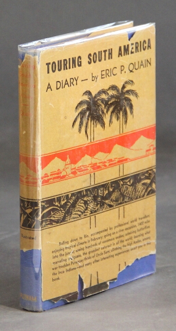
181. Touring South America. A diary. New York: G. P. Putnam's Sons, 1936.
$45
First edition, 12mo., pp. [2] ix, [3], 13-145; map end-papers, frontispiece portrait, 9 illustrations from photographs on 5 plates; fine copy in original blue cloth lettered in orange, signed by author on front free endpaper, dust jacket with significant chips and pieces out at bottom of spine and front and back panel.
An account of a trip from Rio and Sao Paulo to Uruguay across Argentina to Santiago and up the west coast of Chile to Bolivia, Peru, Ecuador and Columbia.
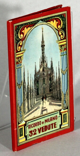
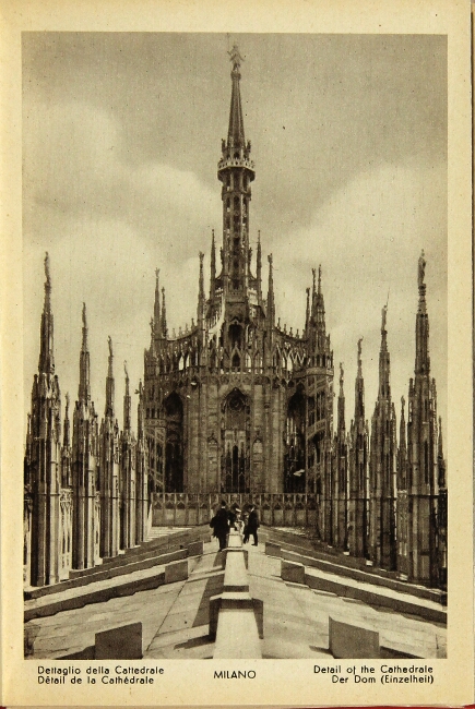
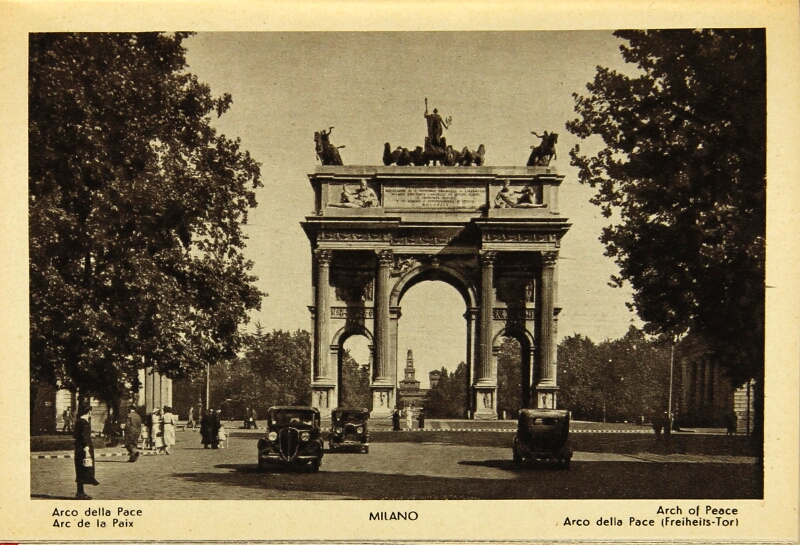
182. Ricordo di Milano. 32 vedute [cover title]. Milano: Frat. T. Scrocchi, n.d., [ca. 1930].
$45
Accordion-fold view book 6¾" x 4½" containing 29 photolithographic illustrations (3 double-page); map endpapers; captions on verso in English, Italian, German, and Spanish; original color pictorial boards; near fine.
Published as no. 258 in the publisher's Riservata series.
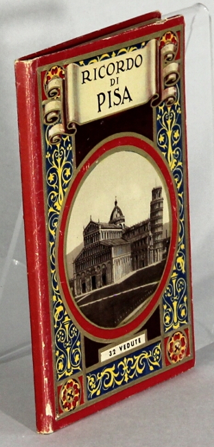
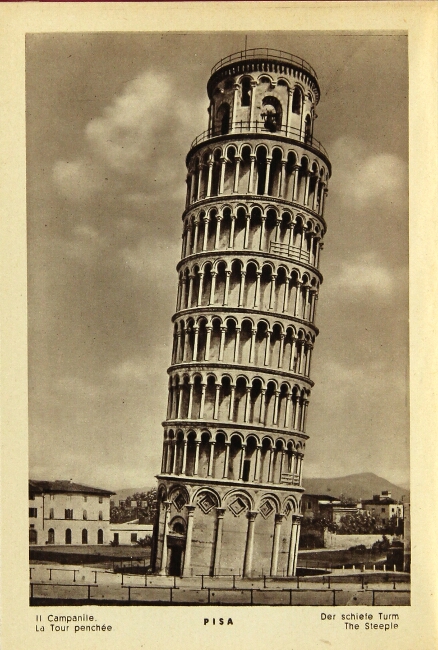
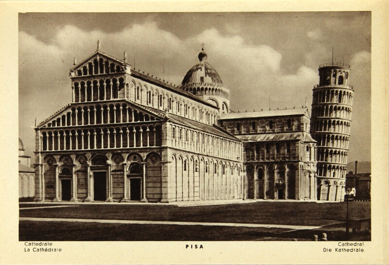
183. Ricordo di Pisa. 32 vedute [cover title]. [Milano: Cesare Capello, n.d.], ca. 1930s].
$45
Accordion-fold view book 6¾" x 4½" containing 31 photolithographic illustrations (1 double-page); map endpapers; captions on verso in English, Italian, German, and Spanish; original decorative color with pictorial pastedowns; lightly rubbed, else very good.
On back cover: CCM (i.e. Cesare Capello, Milano), interlaced. Map after a drawing by Attilio Bartalini.
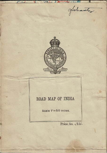
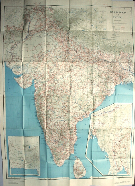
184. Road map of India ... Sixth edition. N.p.: published under the direction of Brigadier C. G. Lewis, Surveyor General of India, printed at the Survey of India Offices, 1945.
$75
Large folding map approx. 42" x 31" printed in blue, red, black, and gray; 2 inset maps of Burma and coastline of Arabian Sea; a very good to fine copy.
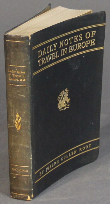
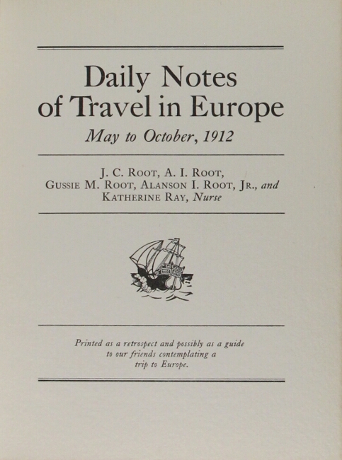
185. Daily notes of travel in Europe May to October, 1912. [N.p.: publisher not identified, n.d., ca. 1913].
$150
Edition limited to 265 numbered and registered copies (this no. 114); square 12mo, pp. [6], 131; portrait frontispiece and 32 plates; minor wear; the spine a bit sunned, else a very good copy in original limp black morocco lettered in gilt on upper cover and spine.
"Printed as a retrospect and possibly as a guide to our friends contemplating a trip to Europe." Published posthumously. Root (1844-1913), at the time of his death living in Lyon (now Clinton), Iowa, was "the most prolific founder of fraternal benefit societies America has ever produced" (see srjarchives.tripod.com for a long biography).
Case Western Reserve only in OCLC.
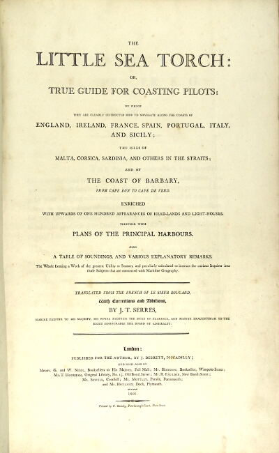
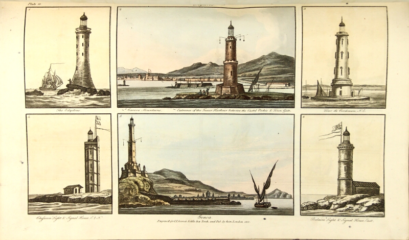
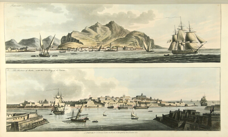

186. [Sailing Directions.] The little sea torch: or, true guide for coasting pilots. London: for the author by J. Debrett, 1801.
$12,500
First edition, folio, pp. [2], [i]-ii, [v]-vi, 144, [6]; likely original marbled boards, rebacked in gilt-paneled brown calf, original red morocco label preserved; minor spotting; a very good, sound, and attractive copy. The subscribers' list contains 171 names taking 191 copies, so the edition was likely a small one. This copy with the engraved bookplate of Joseph Neeld, one of the subscribers.
A lovely work on "how to navigate along the coasts of England, Ireland, France, Spain, Portugal, Italy and Sicily; the isles of Malta, Corsica, Sardinia, and others in the straits; and of the coast of Barbary ... enriched with upwards of one hundred appearances of head-lands and light-houses, together with plans of principal harbours..." With 130 pages of sailing directions for and descriptions of the above-named places, followed by 20 full-page hand-colored aquatints, showing views of about 125 ports, harbor entrances, and harbors. These are followed by 12 engravings with 24 hand-colored charts of harbors and seaports. The text is a translation, with revisions and additions for the British market, from the French of Bougard's Petit Flambeau de la Mer.
Phillips 2852; National Maritime Museum III, 218; Abbey, England, 344.
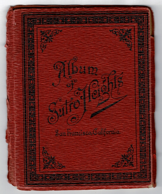
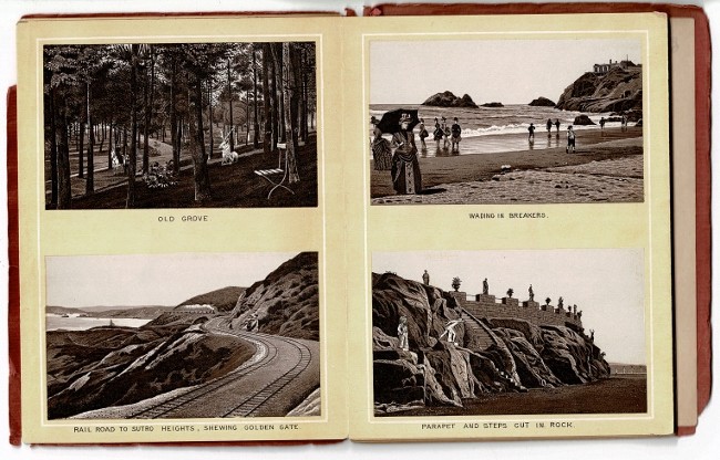
187. [San Francisco.] Album of Sutro Heights, San Francisco, California [cover title]. Leipzig: Carl Garte, n.d., ca. 1889-94.
$125
6¼" x 5", accordion fold with 24 photo-lithograph panels, including a double-p. plan of Sutro Heights, a portrait of Adolph Sutro, beach scenes, statuary, gardens, and 3 scenes of dogs; original decorative red wrappers stamped in black; back cover loose, otherwise very good.
With a 4-p. summary of Sutro Heights affixed to the inside rear cover.
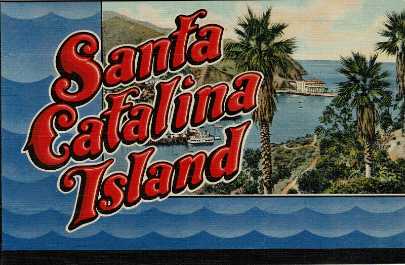
188. Santa Catalina Island [cover title]. Los Angeles: Western Publishing & Novelty Co., [1937?].
$150
Oblong 8vo, introductory text inside front wrapper and 16 leaves with 32 full-page color illustrations from photographs, each withing a decoraqtive line-drawn border printed in red; very attractive and fine, preserving the original pictorial mailing envelope.
Delaware and Newberry only in OCLC.

189. Three men in a motor car or a summer tour in France and Switzerland. New York: E.P. Dutton & Company, [1906].
$45
8vo, pp. xiv, 268; frontispiece, 16 plates, preliminaries lightly foxed and bottom corners clipped on the first 2 leaves; extremities a bit rubbed with some dampstaining to spine ends, else good in original red cloth with decorative color-illustrated upper cover and gilt lettering on spine.

190. A western trip. [Detroit: Herold Press] for private circulation only, n.d., [ca. 1904].
$3,750
8vo, pp. 91, [1]; 12 mounted color photographs by Henry Jackson (variously copyrighted 1902-1905), plus 18 photographic halftones in the text (there is another issue in which these 18 halftones are mounted photographs); title page printed in brown and green, initials printed in green and red; original pictorial tan calf stamped in glt on upper cover, t.e.g., red silk endpapers; some inoffensive old ink stains on the first three leaves of text, else generally fine.
This copy with a warm presentation from the author, "To my kindly, thoughtful friend, J. W. Donovan, in the most momentous month & year in the world's history, November 1918, Carl E. Schmidt."
Description and travel in Yellowstone Park, the author being accompanied by his daughter, Emma, and Frank and Everett Pingree, the latter a miner from Utah. Schmidt (1858-1934) was educated in the schools of Detroit and Germany, and learned the tanning trade from his father. Schmidt worked in his father's firm, which exported skins, furs, and wool, until the latter's death in 1897; soon after, he opened an independent tannery under the name Carl E. Schmidt & Co. He was active in politics, serving as a member of the Detroit Board of Police Commissioners, the state board of arbitration and mediation, and the state board of forest inquiry. He was for some time a close friend and political advisor to Hazen Pingree, who served as both mayor of Detroit and governor of Michigan. In 1880, Schmidt married Alice M. Candler, the daughter of a prominent Detroit businessman. The couple had three daughters: Emma, Alice, and Ida
Wikipedia notes that his home, now the Carl E. and Alice Candler Schmidt House, was built in 1904 at 301 Lake Shore Rd. in Grosse Pointe Farms, Michigan. It was listed on the National Register of Historic Places in 2005. The house is one of the oldest remaining properties in the Grosse Pointes to have a view of Lake Saint Clair.
Howes S-170; Streeter VII, 4123; not in Graff.
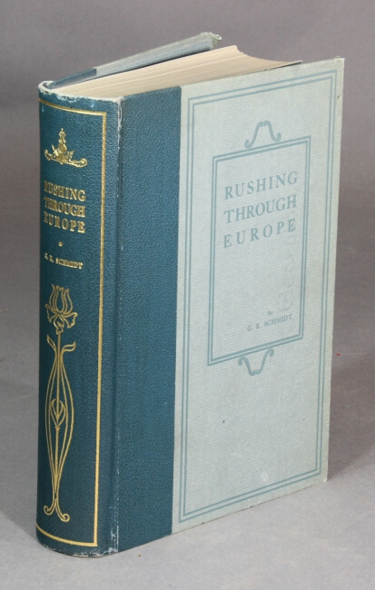
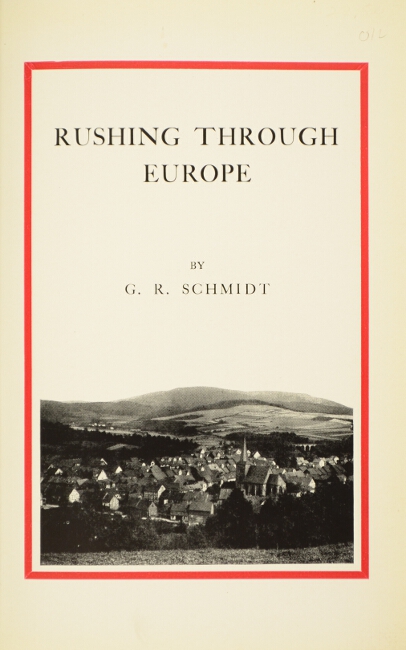
191. Rushing through Europe. [St. Louis: privately printed, 1937.]
$150
First edition, 8vo, pp. viii, 540; photographic title page within a red border, and 11 plates, each showing several photographic illustrations; minor rubbing, some thumb soiling to the fore-edge, else a fine copy in original blue cloth-backed gray paper-covered boards, gilt lettering and decoration on spine.
The Schmidt family from St. Louis does Europe in the summer of 1930. Includes 18 legends of the Rhineland at the back, collected by the author.
Not in OCLC.
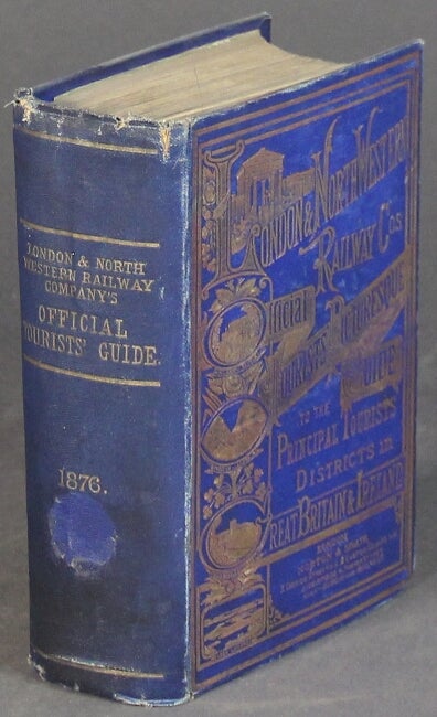
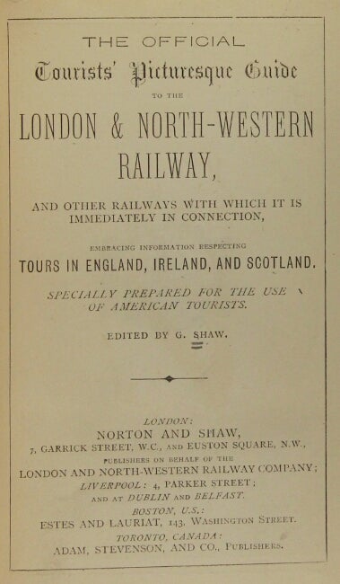
192. The official tourists' picturesque guide to the London & North-Western Railway, and other railways with which it is immediately in connection, embracing information respecting tours in England, Ireland, and Scotland. Specially prepared for the use of American tourists. London: Norton and Shaw; Boston, Estes and Lauriat, n.d., [1876].
$250
8vo, pp. xx, 660; 50 tinted plates (2 folding), 10 folding maps with routes in color, wood-engraved illus. in the text; ads occupy pp. 617-660; ex-MHS with bookplate marked withdrawn and label removed from spine, ads browned, rear hinge cracked, one signature sprung, cracks at top of spine, joints and extremities rubbed, else good in original pictorial blue cloth stamped in gilt on front cover and spine, a.e.g.
Includes sections on the histories of the railways, connections with steam vessels, signals and telegraphs, mail and newspapers, etc.
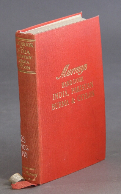
193. A handbook for travellers in India, Pakistan, Burma and Ceylon ... seventeenth edition ... edited by Sir A. C. Lothian.... London: John Murray, 1955.
$30
12mo, pp. cii, 634; large folding map printed in 3 colors (of India and Pakistan) in rear cover pocket, 20 maps (16 folding, 17 printed in 2 colors); an ex-library copy, with perforated stamp in the title, rubberstamp on the verso of the folding map, and call numbers of the spine; all else near fine. Murray's guide to India was originally published in 3 volumes, the first part of which appeared in 1859. This present edition is the first major revision of it since 1933.
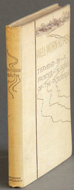
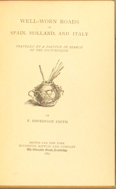
194. Well-worn roads in Spain, Holland, and Italy traveled by a painter in search of the picturesque. Boston & New York: Houghton Mifflin and Co. at The Riverside Press, Cambridge, 1887.
$100
First trade edition of the author's first full book, small 8vo, pp. [8], 121; illustrations by Smith in the text; original pictorial tan cloth stamped in gilt and brown on upper cover and spine, t.e.g.; very good.
According to the publisher's records, 1270 copies were printed.
BAL 18207; American Travellers Abroad S108, citing the large paper edition.
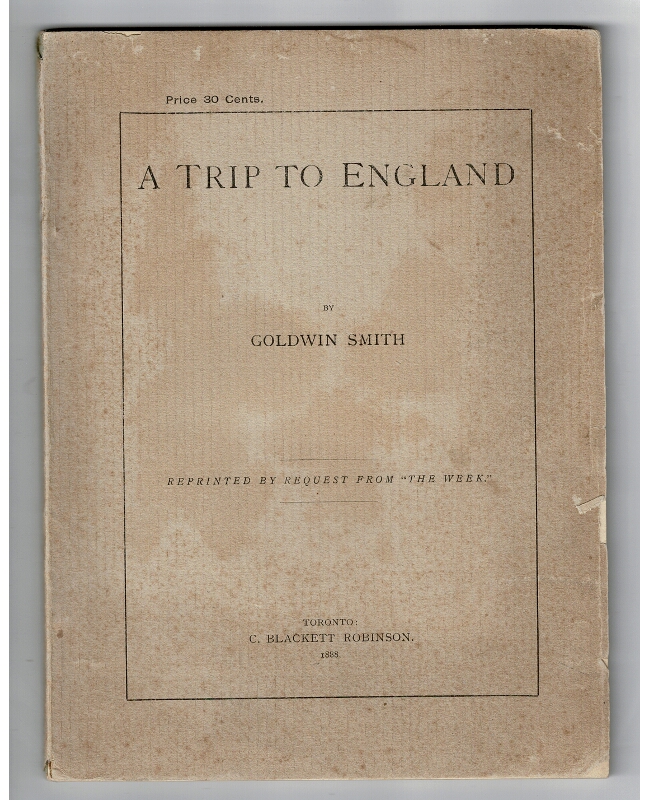
195. A trip to England ... reprinted by request from "The Week.". Toronto: C. Blackett Robinson, 1888.
$75
First separate edition, 8vo, pp. [2], 61; original printed gray wrappers; minor chipping at edges; very good.
American Travellers Abroad, S-110: "Less a narrative about Mr. Smith than it is a description of England and its society. The closest the author comes to referring to the first person is his use of the 'done should...' technique." Maybe not first person singular, but there are plenty of 'we's'. The book was reprinted in New York four years later.
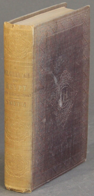
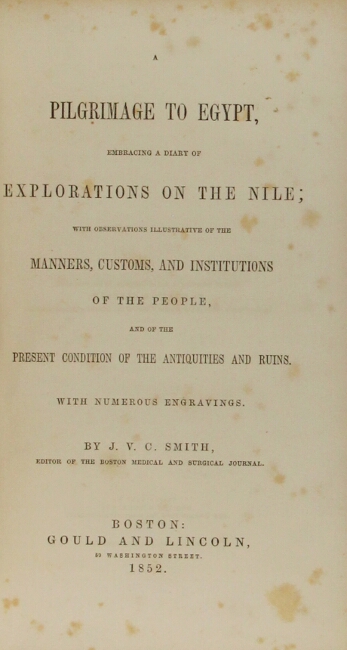

196. A pilgrimage to Egypt, embracing a diary of explorations on the Nile; with observations illustrative of the manners, customs, and institutions of the people, and of the present condition of the antiquities and ruins.. Boston: Gould and Lincoln, 1852.
$225
First edition, small 8vo., pp. [2] ads, xiii, [1], 383, [6] ads; wood-engraved frontispiece, numerous wood engravings in the text (15 full page); spine sunned, otherwise a very good, sound copy in original brown cloth, gilt lettered on spine.
"Nothing more has been recorded [from the diary] than commonly falls within the compass of a traveler's notes, collected especially for the gratification of friends" (preface).
American Travellers Abroad S-115; Ibrahim-Hilmy II, p. 238.
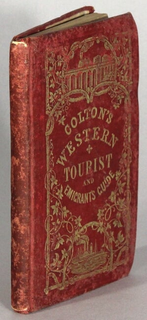
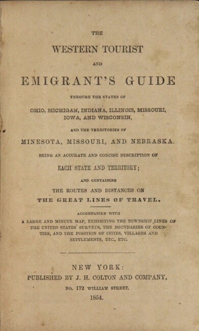
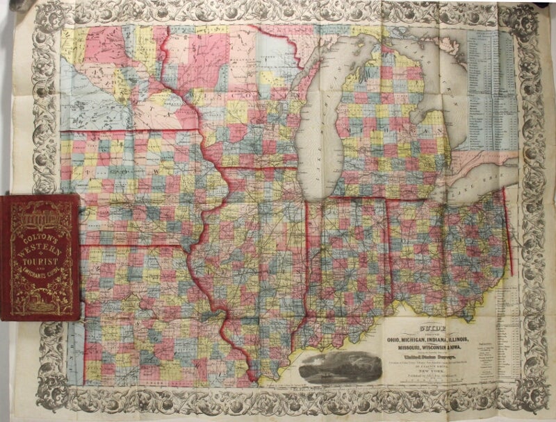
197. The western tourist and emigrant's guide through the states of Ohio, Michigan, Indiana, Illinois, Missouri, Iowa, and Wisconsin, and the territories of Minesota [sic], Missouri, and Nebraska. New York: J.H. Colton & Co., 1854.
$650
16mo, pp. 89, 23, [4]; large folding hand-colored map of the region approx. 21" x 26"; one short split at one fold, otherwise the map is generally in fine condition; original red cloth, gilt stamped on upper cover, extremities rubbed and the binding slightly stained, front free flyleaf excised, old pencil notes on rear flyleaf in German; pretty good copy.
Howes S615.
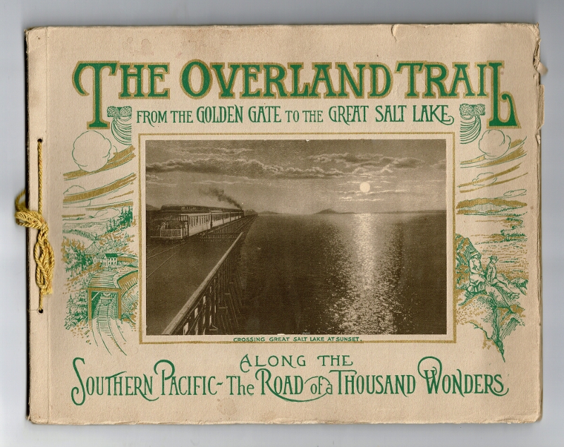
198. The Overland trail. A scenic guide book "Through the Heart of the Sierras" on the line of the Southern Pacific. Chicago: Curt Teich & Co., [n.d.] (ca. early 1900s).
$35
Oblong 4to, unpaginated; 23 full-p. sepia illustrations, mounted (including a folding double-page panorama), map, two pages of text containing illustration descriptions; tan pictorial wrappers lettered in green & gilt, paper label illustration mounted on upper cover, ribbon ties at spine; covers a bit toned and lightly chipped at edges, illustrations clean & bright, overall very good. A picturesque view-book of scenery from the Golden Gate to the Great Salt Lake.
199. Souvenir de Monte-Carlo. Cartes Postales. Les plus belles vues [wrapper title]. [Nice?: E. G. Beausoleil, n.d., ca. 1910?].
$45
Booklet (3½" x 5½") containing 10 photographic postcards of Monte-Carlo; original printed mauve wrappers; near fine.
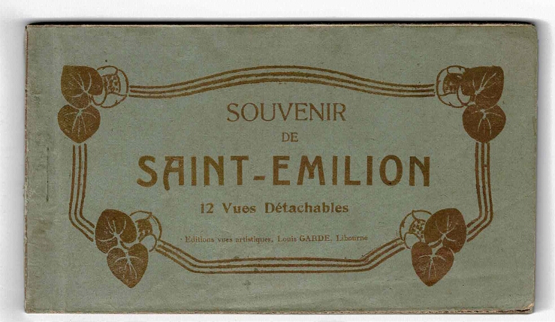
200. Souvenir de Saint-Emilion. 12 vues détachables.. Libourne: Louis Garde, n.d., .
$100
Oblong 24mo (approx. 3½" x 6"), consisting of 2 leaves of text (English and French) plus 12 removable black and white postcards of this important wine region in France; original green wrappers with title printed in gilt within a gilt art deco border; some soiling, else near fine.